The best routes to walk up and near Ben Nevis
The best routes to walk up and near Ben Nevis
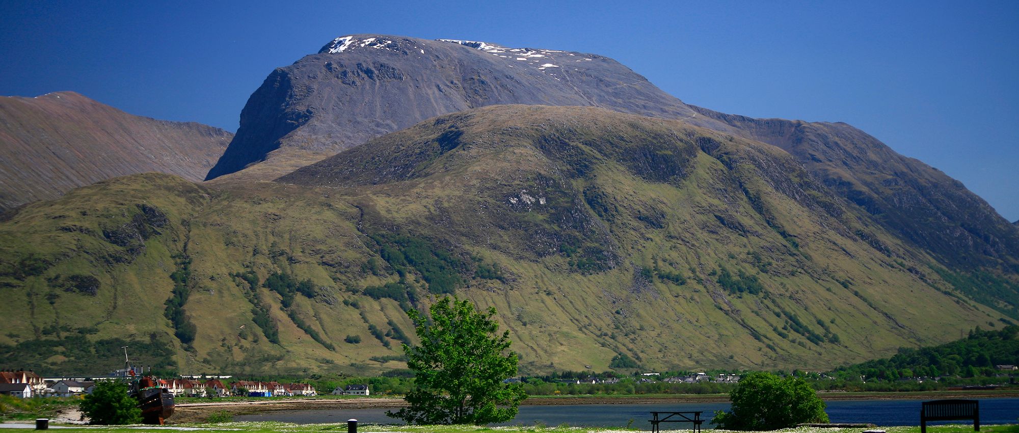
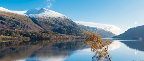
At 1,345m tall, Ben Nevis is the roof of the British Isles. And it presents a formidable challenge that must not be underestimated. Ben Nevis is exposed to the elements. It’s usually shrouded in cloud and often covered in snow. It’s scored with steep gullies and drops in vertiginous cliffs. Tackling the UK’s highest point is an exciting goal that attracts thousands of walkers each year. But extreme care must be taken to make sure you come down safely and have an enjoyable day.
For a start, hikers should wear suitable clothing and footwear. Even if it’s warm below in Fort William, the weather can change quickly and dramatically as you hike up. Expect the summit to be around ten degrees colder than the base, not counting wind chill. Also essential are a compass and weather-proof map (and the ability to use them) plus first aid kit, torch, whistle and fully-charged phone.
There’s also the weather factor. ‘The Ben’, one of only two hills in Scotland over 1,300m, lies on the west coast. This region receives far more precipitation than elsewhere and conditions change quickly. Ben Nevis’s summit will nearly always have the worst weather of the entire area. It is regularly still covered in snow in May or later. Consider whether crampons and walking axes will be required. Winter ascents are only for the very experienced, as daylight hours are reduced and avalanche risk becomes an issue.
One of the best ways to mitigate the dangers is to climb Ben Nevis on a dry, clear day in late summer. That’s also a good way to ensure you have the most fun! Less experienced walkers could always consider hiring a mountain guide for the day. There are many in Fort William. Doing this is a good opportunity to learn new skills too.
Also, you don’t have to tackle Ben Nevis to enjoy a hike in this area of the Highlands. Indeed, pick another option and you’ll probably have a less-crowded day out. Plus you’ll get views of the big Ben itself.
Mountain Path - The classic way up Ben Nevis
Once called the ‘Tourist Path’, the main route up Ben Nevis may be extremely popular but it’s no walk in the park. It involves 1,352m of climbing over 10.5 miles of steep, rough, rocky terrain, probably taking seven or eight hours. It’s only for the fit and well-prepared.
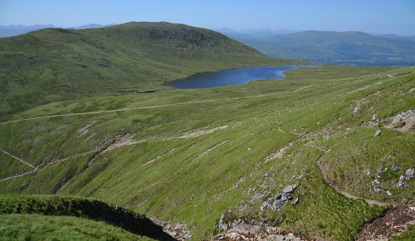
The trail begins at the Glen Nevis visitor centre, crosses the River Nevis bridge and starts climbing steadily, then more sharply up steps. You’ll pass Lochan Meall an t'Suidhe (‘Halfway Lochan’), from where there are dramatic views. Then you’ll walk in wide zigzags, traversing boulders and scree to reach the summit plateau. Though the way flattens here, this is the most treacherous part. You must navigate a dog-leg between Five-Finger Gully, on the south side, and Gardyloo Gully, on the north. Sadly both have been the scene of several accidents. Also beware of overhanging cornices of snow, particularly above the North Face.
Having reached the top, savour it. Here you’ll find a trig point, the remains of a meteorological observatory and old hotel, and astonishing views in all directions. Then take extreme care steering between the gullies again, tracing the same route back down.
Note: be sure to stick to the zigzags, rather than taking a direct line down the Red Burn.
Finish up in the excellent Ben Nevis Inn, at the foot of the mountain. In this cosy pub and bunkhouse, historic photos dot the walls, live music is often played and local beers and whiskeys are served.
CIC Hut Hike - a moderate hike to the UK’s only alpine refuge
For a scenic taster of mountain hiking without too much effort, this 7-mile out-and-back route is a gem. Starting near Torlundy, it runs to the CIC Hut, built in memory of Charles Inglis Clark who was killed during the First World War. Perched at 680m, with beds for 26 people, it’s the only alpine-style hut in the UK. It also has extraordinary views of Ben Nevis’s sheer and complex North Face, a perspective not seen by hikers who ascend by the Mountain Track.
Start from the North Face car park. There’s a stiff climb through woodland, then above birch-cloaked slopes, with benches looking across Fort William and Loch Linnhe. Look for mewing buzzards and croaking ravens riding the thermals overhead.
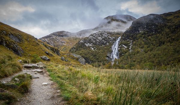
From here you’re walking into the towering embrace of Ben Nevis and Càrn Mòr Dearg, linked by the windswept Càrn Mòr Dearg Arête ridge. As the glen narrows, stepping-stones hop across trickling burns and the cliffs come ever closer. Waterfalls flank the final push to the hut, where you can sit and soak up the surroundings before heading back the same way. British landscapes don’t get much bigger or better.
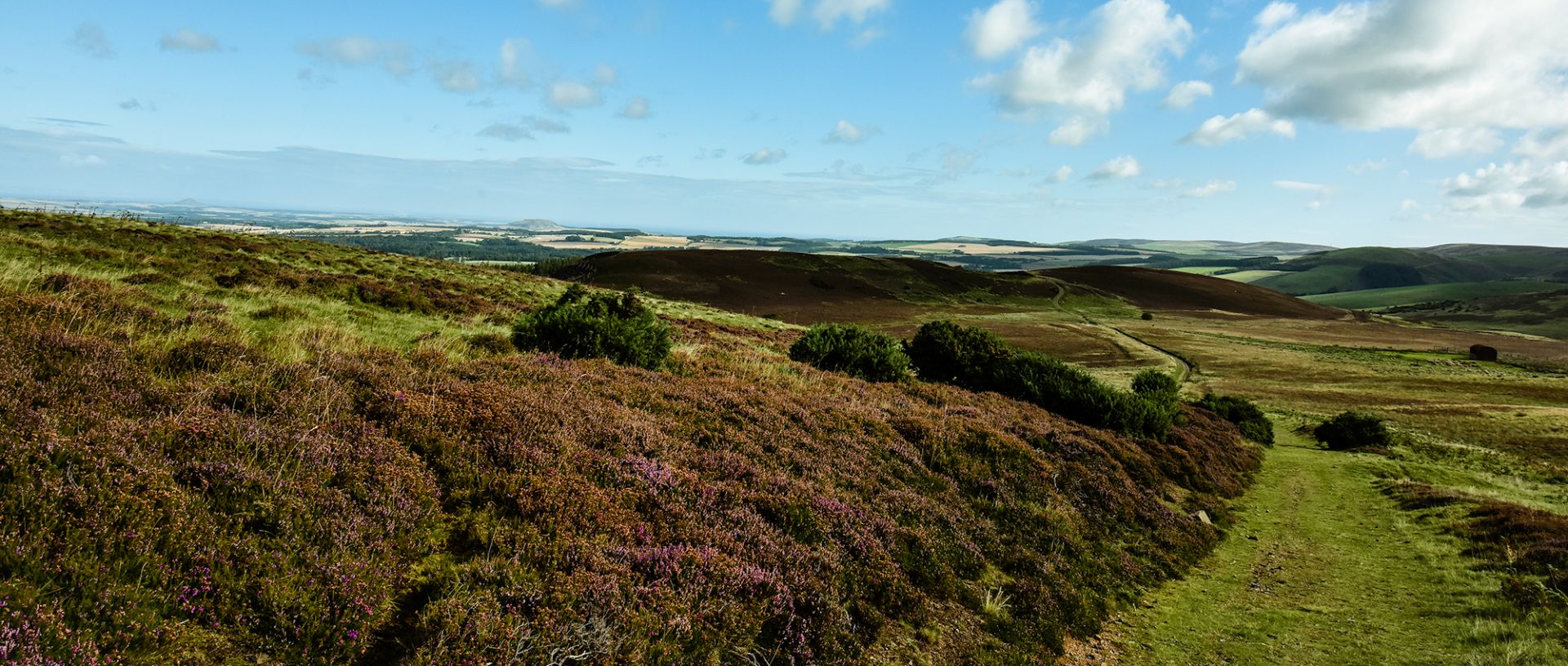
Glen Nevis and Polldubh Falls - an amble along The Ben’s glen
This 8-mile loop offers an easy stroll in the shadow of Ben Nevis, saving you the effort of tackling its top. The landscape is still breathtaking though. The crystal-clear River Nevis is a constant companion. There are incredible regenerating pinewoods all around. And there are epic views up to summits such as scree-scattered Sgùrr a Mhàim and imposing Stob Bàn.
Start from the upper Glen Nevis car park. You’ll soon lose the hordes heading up the Mountain Path as you trace the river. The magnificent middle section of the valley features bursts of spring wildflowers, fine old trees and the burial ground of Ach nan Con. Eventually you’ll reach the Lower Falls at Polldubh, where the river plummets noisily over a 10m drop. The return, on the opposite bank, is via a wide, easy forest track, with more glorious views down the glen.
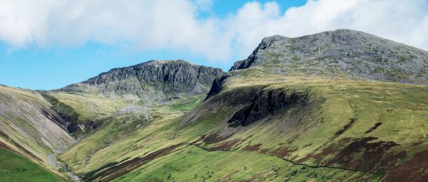
Ben Nevis via Càrn Mòr Dearg Arête - for experts only
The ascent via the Càrn Mòr Dearg Arête is spectacular. You’ll find far fewer people. You’ll also be treated to exquisite views over Loch Linnhe and close-ups of the gullies and buttresses of Ben Nevis’s monstrous North Face. However, it involves a very exposed ridge scramble so is not suitable for the vast majority of walkers.
There are other ways up Ben Nevis but they are only for very experienced mountaineers. For instance, the ‘Waterslide’ route up from Glen Nevis is mostly pathless and extremely steep. The Ledge Route, up the North Face, is a Grade One scramble surrounded by technical climbing terrain which requires mountaineering skills.
Explore more
We’ve got ideas for hundreds of wonderful walking routes across England, Scotland and Wales, long and short, easy and challenging. Search for routes on our website. Or join a guided walk with a local Ramblers group. Find your nearest Ramblers group and choose a walk that suits your pace, fitness and interests.
All images © Getty
The best routes to walk up Pen y Fan
Discover the finest paths up and around the tallest mountain of Bannau Brycheiniog (the Brecon Beacons).
The best walking routes up Scafell Pike
Plan the best hike up Scarfell Pike, England’s highest summit and also consider: should you climb it at all?
The ultimate guide to walking up Helvellyn via Striding Edge
How you can hike and scramble up the magnificent Helvellyn, one of the Lake District’s biggest and most iconic mountains.
Campaign with us
We campaign to remove barriers to walking and we step up to protect the places we love to wander.