Summary

A gently undulating walk on moorland, including a stretch of the Two Moors Way, pastures, quiet country lanes, prehistoric hut circles, menhirs and stone rows.
Difficulty:
Moderate
Distance:
10.1 miles (16.2 km)
Walking time:
05h 30m
Type:
Circular

Start location

Widecombe-in-the-Moor village green, TQ13 7TA

lat: 50.5770907

lon: -3.811955

Map

Elevation

Route

1 of 0

Getting there

By bus: Buses 672 from Newton Abbot.   https://bustimes.org.uk/localities/E0045518

Note: grid ref at start is SX719768. 

Waypoints

1

Leave Widecombe-in-the-Moor village green, with the Old Inn on your right-hand side to the left past the church (turning signposted “Rugglestone Inn 1/4 mile”). Follow it downhill and you will shortly reach Venton Bridge, just before which the footpath crosses a stile to the left and runs over a field alongside a stream. Once you’ve reached the road, turn left and immediately right up the lane with a wood to your left. After a level start, the road begins to steepen as it nears the hamlet of Bonehill, levelling off at a break in the wall, with granite posts each side and Bonehill Rocks rising to the right. You can take a short diversion south from here to Bonehill Rocks to hunt for the letterbox (see below). Otherwise turn left opposite the car park, away from Bonehill, and follow the path uphill to Bell Tor.

2

From the foot of Bell Tor, a path drops down to the east, skirting the boggy, flat ground below to reach the road at SX739779, where you should turn left. After a cattle grid, ignore the five bar gate on your right and continue instead to the gate/stile and fingerpost, which leads on to Holwell Lawn and pony club access land. Follow a right fork across the field past jumps until you arrive at a breach in an old drystone wall. Here you turn left and follow the wall in a northerly direction as far as a second wall running at right-angles to the first. A signposted stile then leads you to the start of a clear path, which forks left through bracken-covered moorland up to Hound Tor (A). It’s well worth having a look around the rocks. (A) Just to the southeast of Hound Tor, one of Dartmoor’s most spectacular rock formations, you can see the remains of longhouses constructed around 500AD by Saxon settlers, alongside remains of later medieval cottages. A giant pile of weirdly shaped boulders, towers and clefts, Hound Tor has long fascinated visitors to Dartmoor.Conan Doyle was inspired to write The Hound of the Baskervilles after a visit, and the tor remains the subject of numerous local legends. In 2007, a walker claimed to have spotted a large, black, bear-like “beast” ambling around it. More bizarrely, an episode of EastEnders was also once filmed here.

3

Skirt the west side of the tor, dropping down the far side to the car park. Turn left onto the junction at Swallerton Gate, walk past the house (on your left) and follow the middle of three lanes N (signposted “Manaton”). Some 8 mins later you arrive at a metal five-bar gate. In the field on your left you may be lucky and spot some alpacas. At the gate, cross and follow the path to the right over Hayne Down and Bowerman’s Nose rock formation (B) (SX742804). (B) Another famous Dartmoor rock formation rises to the north of Hound Tor, at the tip of Hayne Down. Bowerman’s Nose, a 6.6- metre/21.5-feet tall pillar, stands alone above a so-called “clitter” of granite blocks that have fallen over the years from the outcrop of which it once formed the core. Resembling an old man in a flat cap, the statue stares mutely across a glorious sweep of walled pasture and moorland. Local legend has it that Bowerman was a hunter turned to stone by a coven of witches whose cauldron he mistakenly spilled.

4

From Bowerman’s Nose, retrace your steps back to the metal five-bar gate, on the far side of which a path strikes westwards (to the right), uphill across pasture and over hilltop via a series of five stiles and gates. The track eventually drops down to a road, on the far side of which stands Kitty Jay’s Grave. (C) (C) With a blank headstone standing at its head, the humble grave of Kitty Jay is the last resting place of a pauper’s daughter who left the workhouse to enter the service of a local landowner in 1790 and fell pregnant by the son of the household. Cast out by the family and with no prospect of future employment, Kitty hanged herself. But suicide being deemed a mortal sin at the time, she could not be buried in a churchyard. Instead, her body was placed in a rough hole dug on the borders of the parish, at a lonely intersection of moorland tracks from where Kitty Jay’s spirit could not return to haunt the god-fearing locals. For decades, fresh flowers have mysteriously appeared on it, said to have been placed there during the night by a hooded figure, while passers-by leave lucky pennies and crosses made from twigs.

5

Our route then continues along the wooded lane behind the grave. There will be lovely views to the left from this lane. You will arrive at another road just north of Natsworthy Manor.

6

You can cut the walk short here by turning left for Widecombe. Otherwise, look for the gate and signposted path diagonally opposite (to the left). This leads initially along the south flank of a conifer plantation but after 5 minutes starts to drift left. At a fork in the path 5 minutes later, bear right heading for the saddle pass in the ridge above. Keep to the well-worn path as it drops down the other side to Grimspound (D). (D) Following the disappearance of the tree cover, farming and herding continued through the late-Bronze Age, when tin and copper (the main constituents of bronze) were extensively mined in the area, and Dartmoor’s inhabitants lived in large stone enclosures. You gain a vivid sense of what life must have been like for them at Grimspound, where a circle of heaped boulders ring the ruins of 24 huts dating from 1500–1300BC. Huddled in a hollow flanked by Hameldown and Hookney Tors, it’s a superbly atmospheric site with fine views across the valley to ridges serrated by lonely stone rows and menhirs. Paved entranceways, L-shaped porches, hearths for peat fires and sleeping platforms are still discernable in some of the hut circles. Grimspound’s chef d’oeuvre, however, is the monumental entrance on the south side of the enclosure, made from a pair of huge granite door jambs.Pollen samples extracted from Grimspound suggest the site was probably deserted around 1300BC, when the climate grew suddenly colder and wetter. Seven or more centuries elapsed before the weather improved sufficiently to permit farming again.

7

From the southern gateway of Grimspound, a clear path strikes SE, steeply uphill, to Hameldown Tor. Continue across Hamel Down for about 3 kilometres. A useful navigation aid in poor visibility is the corner of the drystone wall at SX706792. The path hugs this wall, but peels left at Hamn Beacon, arcing along the shoulder of the descending slope to the corner of another drystone wall at SX707776.

8

Follow the wall straight ahead, following the signpost that points to Widecombe. At another footpath sign you will leave the wall and carry straight on. The path drops down to a 5-bar gate. Go through this onto an enclosed track. You will shortly join a metalled lane and drop steeply downhill via the lane for 5 minutes, where you turn right for the village centre.

Notes

When: September to coincide with Widecombe Fair

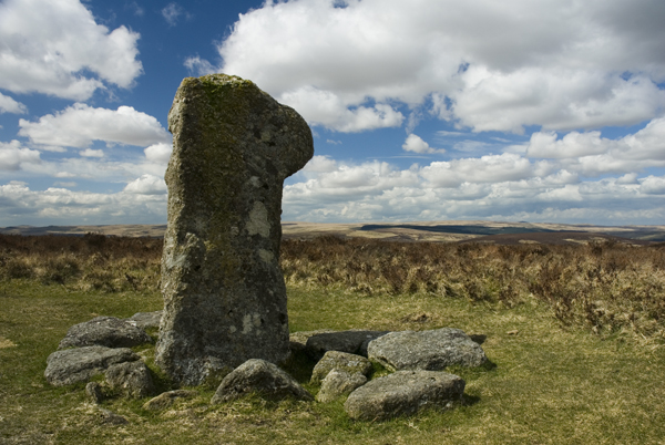
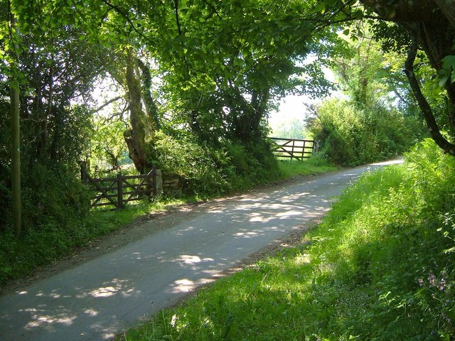
Terrain:  Mostly open, gently undulating moorland, with some stretches across pasture and along quiet country lanes; includes a few short, steep ascents.

Maps: OS Explorer OL28.

Eating & drinking: village pubs

Sleeping: Accommodation in Widecombe-in-the-Moor

Visitor Information: Dartmoor Information Point, Church House, Widecombe-in-the-Moor 01364 621321
The High Moorland Visitor Centre Princetown 01822 890414 www.dartmoor-npa.gov.uk

Letterbox 100 Club www.letterboxingondartmoor. co.uk. The letterboxing homepage, with complete clue catalogue. 
Crossing’s Guide to Dartmoor Peninsula Press). The definitive guide to the region, first published in 1912.
Dartmoor Guide Free newspaper published annually by the national park.  www.widecombe-in-the-moor.com. The village’s information packed website.
www.legendarydartmoor.co.uk. A huge compendium of myths, fables and history.
www.virtuallydartmoor.org.uk Combines oral history and archive photographs with 360-degree panoramas to explore various locations on the moor.

More Walks:  John Musgrave Heritage Trail (South Devon Ramblers). The 56-km/35-mile trail was created from a generous legacy left by former South Devon Ramblers chairman John Musgrave. The trail is split into four managable sections of between 9km/5.5miles and 18km/11miles each. The guide provides detailed commentary on local heritage, maps and transport links along the way. See also http://www.southdevonramblers.com/john_musgrave_heritage_trail.php

Problem with this route?

If you encounter a problem on this walk, please let us know by emailing volunteersupport@ramblers.zendesk.com. If the issue is with a public path or access please also contact the local highways authority directly, or find out more about solving problems on public paths on our website.

Join the Ramblers and enjoy

  • unlimited free access to 50,000 Ramblers group walks
  • a library jam-packed with thousands of tried-and-tested routes
  • a welcome pack teeming with top tips plus our Walk magazine
  • exclusive discounts from our partners
  • knowing your support is opening up more places to walk and helping more people discover the joy of walking

Sharing

Join the Ramblers and enjoy

  • unlimited free access to 50,000 Ramblers group walks
  • a library jam-packed with thousands of tried-and-tested routes
  • a welcome pack teeming with top tips plus our Walk magazine
  • exclusive discounts from our partners
  • knowing your support is opening up more places to walk and helping more people discover the joy of walking