1
Leave Guildford station via the main exit by following signs to Guildford Town Centre (if you find yourself at the other exit, on Guildford Park Road, turn left along the road and join the route at the mini-roundabout). On leaving the ticket hall at the main exit, turn right and follow the path alongside the station approach road. At the end of this road stay on the path and follow it round to the right and uphill to reach the start of the road bridge over the railway (Farnham Road). Cross the road at the traffic lights and turn right to follow the road over the bridge. At the other side of the bridge, pass a pedestrian exit from the Farnham Road Car Park and then, next to a mini-roundabout, turn left along a passage which goes uphill alongside the car park. Go to the top of the passage, ignoring a turning on the right and arriving in Wodeland Avenue, next to another pedestrian exit from the car park. Cross the road and turn left to cross the end of Mareschal Road. Go up some steps signed "To The Mount" and follow the passage, which soon leads down some more steps. Turn right and walk up The Mount, which justifies its name by providing a steady climb and soon takes you past The Mount Cemetery (A) on the left.
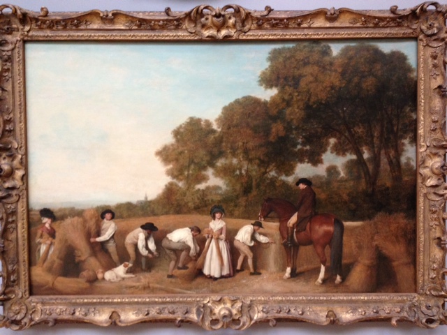
The Mount Cemetery (A) includes the grave of Lewis Carroll (Rev Charles Dodgson) and members of his family. The Cemetery also contains a small chapel used by the little known English Orthodox Church. Lewis Carroll is interred near to the Chapel. He lived in Castle Hill, Guildford and is most famous for creating Alice in Wonderland.
The steps down into The Mount in Waypoint 1 are steep and will be slippery if wet. These steps lead you straight out on to The Mount so take care with traffic, although thankfully this is a quiet road
2
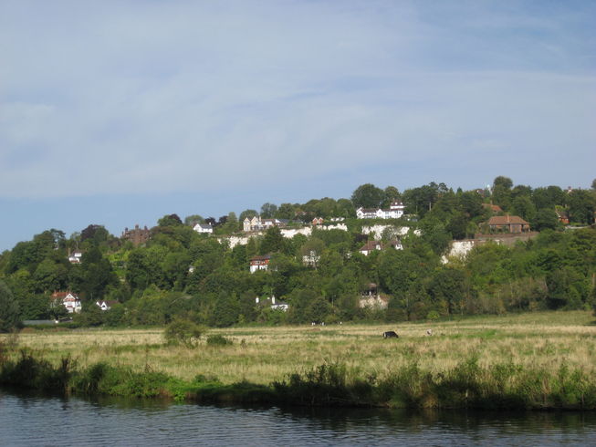
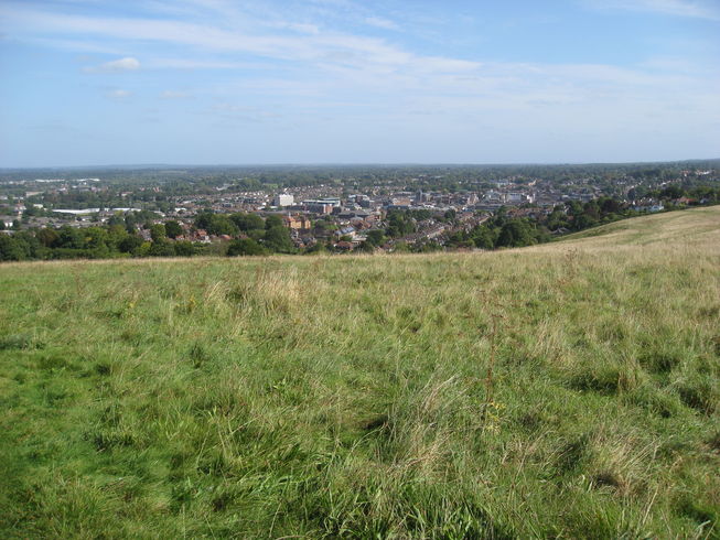
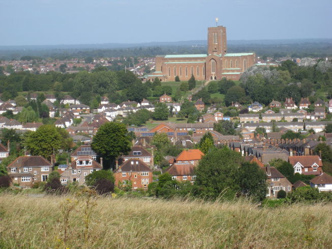
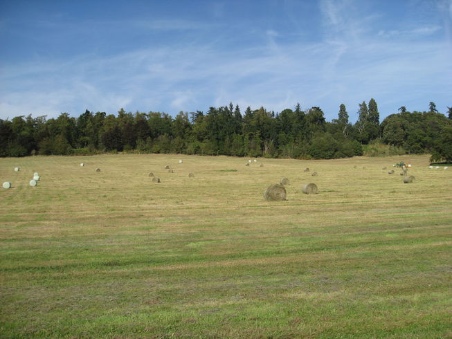
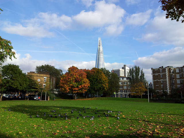
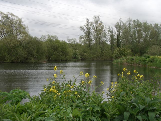
Continue up The Mount ignoring footpaths on the right and left, until after a turning circle, it becomes a narrower lane. Immediately after the last house on the right there are two paths leaving the road to the right. Take the one on the left to emerge onto the downs. Take the path to the left which follows the line of the trees. You have now completed the worst of the climbing on this route and as you follow this path (or take a break) you can reward yourself by enjoying the views. These are dominated by Guildford Cathedral but you can also see parts of the University of Surrey and Guildford town. Further afield there is Woking and beyond it you may be able to see aircraft landing at Heathrow airport. To the right, on a clear day, you can see London landmarks such as Wembley Stadium, the London Eye and Canada Wharf.
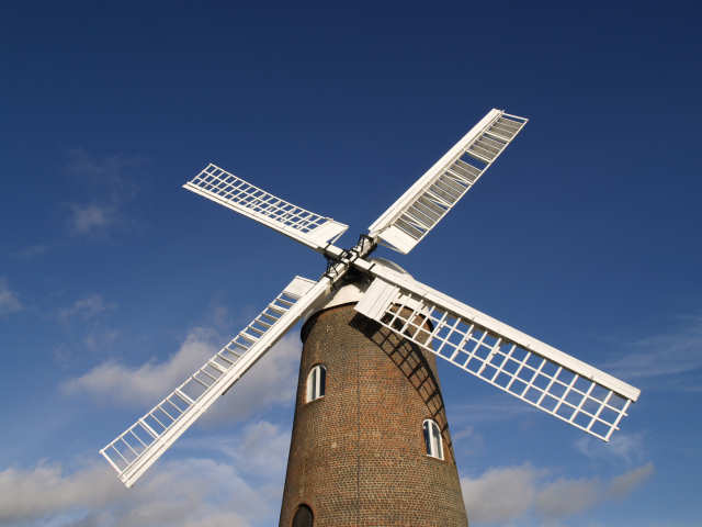
Guildford Cathedral (B) was designed by Edward Maufe and construction started in the 1930s. Work was delayed by the 2nd World War and the cathedral wasn't consecrated until 1961. It sits on Stag Hill and clay excavated from the hill was used for many of its bricks. Subscribers could buy a brick for 2s 6d (12½p) and inscribe it with their name
3
Follow the path parallel to the trees to the far corner of the field, where there is a stone commemorating the 500th Anniversary of a Cornish march to London in 1497. There was a brief, inconclusive battle between the Cornish rebels and the King's men just outside Guildford at Gil Down in June 1497. Do not leave the field here, but turn right to walk parallel to the field edge downhill until you reach a path leading to a gate into woodland on the left. Go through this gate and pass through a short stretch of woodland before going through another gate and emerging into a field. Continue straight ahead and go through two more sets of gates. There may be livestock grazing in these fields. The views to your right now include the Surrey Sports Park, which is part of the university. In the third field ignore a path on the left immediately after the Gate and after c. 200m you will see a path coming up from the road to cross your route. Turn left onto this path and go though a gate into woodland. The path soon reaches a track and you should turn right and follow this. As you walk along this track, after 2-3 minutes, you need to look out for the start of a small footpath set back on the left. The path is marked by a finger post but this may be hidden by vegetation until you are level with it (if you reach a path leading to a gate on the right you have gone too far!).
4
Take this path, which is narrow and goes quite steeply downhill. The chalky surface may be slippery when wet. You now have good views in the opposite direction to those from the downs and the outlook here is much more rural. You have crossed the ridge that becomes the Hogg's Back further west and are entering the Surrey Hills Area of Outstanding Natural Beauty. Follow the path to the bottom of the valley (you may need to move onto the parallel track near the bottom if the path is overgrown). The route joins a track leading from a house at Conduit Farm on the right. Continue ahead on this track until it turns sharp left, where you should bear right on a footpath and continue round to the right. You are now on part of the North Downs Way, the long distance footpath which goes from Farnham to Dover. Follow the path straight ahead. You will notice that you have left the chalk of the downs and are now on sand, which can make the going heavy in places. When you reach a crossroads of paths in a dip, the main route goes downhill to the left.
The chalky path at the start of this waypoint is fairly narrow and bordered on the right by a wire fence topped with a single line of barbed wire. Be careful, especially if wet
For an additional 2 km / 1.3 miles you can visit Watts Gallery and the Watts Cemetery Chapel. Continue straight ahead on the North Downs Way, which starts as a path and them becomes a sandy track. In about 10-12 minutes you will see Watts Gallery (C) on your right, and will soon reach Down Lane, Compton, where there is access to the gallery and its tea room. Watts Gallery (C) is dedicated to the work of the Victorian artist G.F.Watts. It has existed for more than a century but has been fully refurbished to improve the presentation of his work On leaving the gallery turn left along the road and continue for 4-5 minutes until you see a cemetery on the left. Enter the cemetery and follow the main path uphill. You will see a red brick building which is the Watts Cemetery Chapel (D). Watts Cemetery Chapel (D) was created by Mary Watts, wife of G.F. Watts, and has been described as "a unique fusion of art nouveau, Celtic, Romanesque and Egyptian influence with Mary's own original style"On leaving the cemetery through the same gate, turn right to return along the road for 1-2 minutes before taking a footpath through a gate on the right. This path takes you between a hedge and fields, then turns left to pass through a gate into a yard. Cross the yard then turn right and follow a concrete path, ignoring a footpath to the left. At the end of this path turn right through a gate and then immediately left into a field. Cross the field then continue along a hedgerow with another field to the left. Stay on this path until it descends some steep steps. Turn right to join the main route just before Little Polsted..
5
After turning left follow the narrow path through woodland, then alongside fields before dipping between trees. Ignore a path up steep steps to the right. Shortly after this you reach a track at Little Polsted. Turn left, go round the barrier (an old gate) and follow the track straight ahead. Pass through a gate near a house on the left and eventually reach a gate which is a private entrance to Loseley Park. Turn left just before the gate to follow a narrow footpath, which soon turns right. Cross a track and a stile and continue straight ahead with a good view of Loseley House (E) to the right. Pass through a gate leading to a small lake with benches. After a lot of rain this lakeside area may be waterlogged, in which don't pass through the gate and stay in the field as you will naturally rejoin the route.
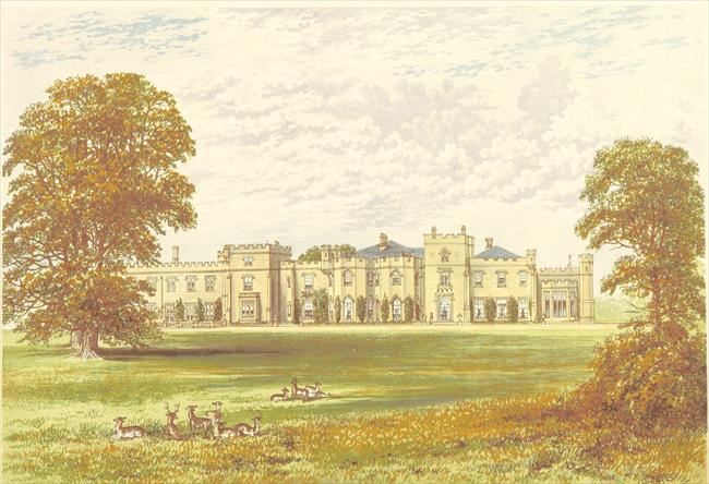
Loseley House (E) sits in extensive parkland and much of the farmland seen on this walk is on the Loseley Estate. The house dates from the 16th Century and is the home of the More-Molyneux family. The house, gardens and park are open to the public at limited times given on its web site. It is also widely used for private functions. The walk does not go near the public entrance to the park.
6
Continue with the lake to your right and pass through another gate straight ahead. The path continues through two fields and you then pass through a gate leading to a track between houses at Littleton. You soon reach a road, which you should cross and continue ahead past more houses. The track soon narrows and becomes a footpath. At the next intersection, just before a bench, take the footpath to the left. This footpath goes through woodland and, on the right, passes the Surrey Police HQ of Mount Browne. It emerges on a short roadway which leads to a tee junction with a road to Mount Browne. Continue straight ahead and go through a gap in the wall on the far side of this road to continue on a footpath. This path goes through woods and passes a car park for Mount Browne. It eventually joins Sandy Lane and you should continue ahead along this lane until the tee junction. Cross the main road and turn right, passing Ye Olde Ship Inn, and shortly afterwards turn left into Ferry Lane following signs to the North Downs Way (which you have rejoined for a short distance). To your right is St Catherine's Hill, and on the top of the hill are the ruins of St Catherines Chapel (F).
St Catherine's Chapel (F) in Artington dates from the 14th Century. It sits on a hill between the Portsmouth Road and the River Wey. The London to Portsmouth Railway passes underneath it and the North Downs Way alongside it. The suggestion that it was a stopping off point for pilgrims travelling from Winchester to Canterbury is therefore not surprising. Although it is only a ruin now there are good views from the hill.
Take care crossing the main road at the Ye Olde Ship Inn, as it is a busy road and narrow pavement on the other side. Thankfully this stretch is only 50 metres or so
7
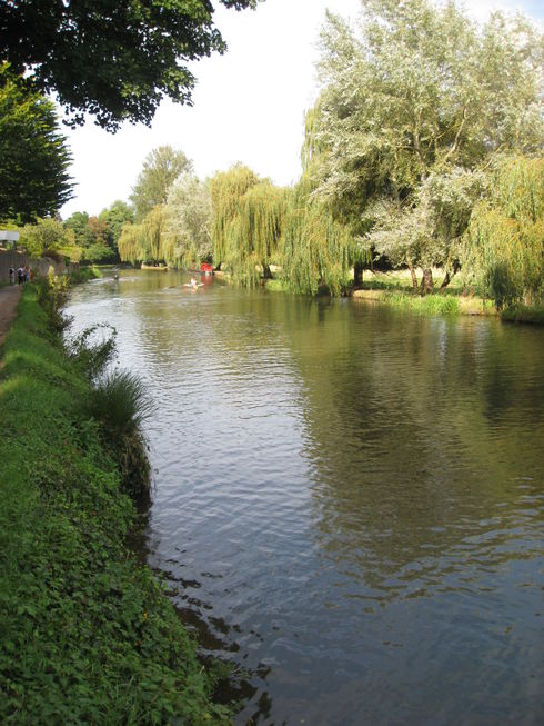
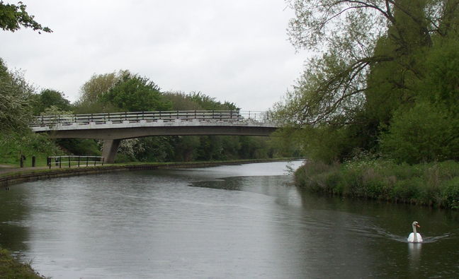
Stay on Ferry Lane and follow the lane over the railway and downhill to join a path leading to the river. Turn left along the towpath, which can be muddy after wet weather. There are good views across the water meadows to the chalk hills of Guildford. You may be able to see Guildford Castle through the trees ahead. You are now following the River Wey Navigations (G).
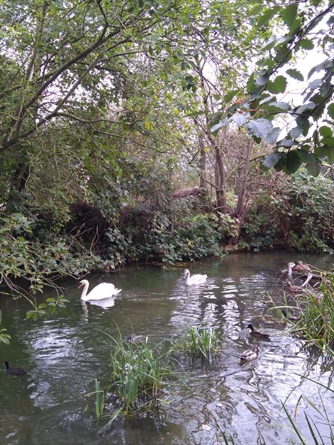
The River Wey Navigations (G) are operated by the National Trust. The Wey was one of the first British rivers to be made navigable, and opened to barge traffic in 1653. This 15-mile waterway linked Guildford to Weybridge on the Thames, and then to London. The Godalming Navigation, opened in 1764, enabled barges to work a further four miles upriver. The route is now used mainly by leisure craft. As well as the waterway there are extensive wetlands which provide a rich habitat for wildlife.
8
Continue until you cross some sluice gates and arrive at a grassy area. Take the path to the left which crosses the grassy area and rejoins the towpath at some more sluice gates. Cross these and continue until you reach Guildford Lock. Turn left after the lock and cross a white footbridge. Turn right after the bridge and continue alongside the river with a car park and the Britannia pub to your left. At the end of the car park cross the road to stay on the footpath then cross back when the towpath resumes. Pass an area of grass with a bronze tribute to Lewis Carroll and pass the White House pub before turning left to skirt a bridge. If you look over the bridge you will see Guildford High Street going up the hill. This is a good point to leave the walk if you want to explore Guildford town centre. To complete the walk don't cross the bridge but continue with the river to your right. You will pass under two road bridges and then a footbridge which is opposite the Odeon cinema. Immediately after the footbridge take the steps up to the road. Cross the road, turn left to walk up a ramp then turn right to cross the car park. This brings you to Guildford station ticket hall and the end of the walk.