1
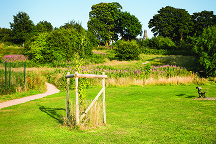
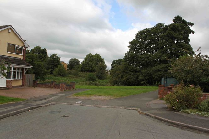
Leave Oswestry Bus Station by walking behind Morrisons Store and turning left into Oswald Road. Walk alongside the store to the pedestrian lights, cross the road and continue in the same direction to the traffic lights. Turn right into Thomas Savin Road, cross the Cambrian Railway line and follow the pavement as it bends right and enter Wilfred Owen Green (where there is an Oswald’s Trail Information board). To continue on the main route; after entering Wilfred Owen Green, by the information board immediately turn left and follow the gravel path along the edge of the green (medical centre car park immediately on your left), after a short distance take the path as it swings left and goes gently uphill behind some factory buildings. Continue to follow the path as it heads downhill to reach some bollards and the access to a road (Queen Elizabeth Drive). Turn left and follow Queen Elizabeth Drive to the junction with Unicorn Road. Now cross diagonally left over Unicorn Road to enter Windsor Road and continue along until just before the end; then bear then bear left through the wildlife area to come out on Harlech Road. Cross diagonally left over Harlech Road to enter a tarmac pedestrian way (with a green metal fence on the left hand side).
A new section of footpath can reduce the east section of the walk to around 1 mile and the total distance to 11 miles. To do this turn away from the information board and head in a roughly southerly direction along the winding path through Wilfred Owen Green. At the end, turn right for a short distance and then left on a path which follows the railway line under one bridge and on to the next known locally as Gas Works Bridge. Leave the path and turn left into Shrewsbury Road to arrive at pedestrian lights. Cross the road then head back in the opposite direction before turning left into Maesbury Road and arrive at the start of the Southern Section on Page 6.
2
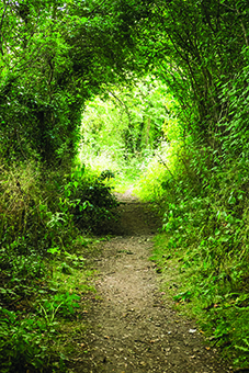
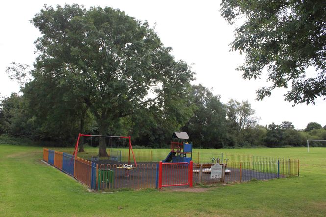
At the end of the pedestrian way follow a hard surfaced track running through a wooded area (the buffer zone between the houses and the A5) and continue along the path to a football practice area, where the path once again becomes a tarmac-surfaced path. Take the path alongside the football practice area and past a children’s play area and then take a short set of steps down into a grassed area. Continue along the path passing along the backs of houses (with the A5 a little way to the left) to pass through the Eaton Fields and pond area. Just a short way past the pond the path reaches a gate onto Middleton Road. Go through the gate, turn right and go along Middleton Road to the junction with Middleton Way (be careful on this section as the road is narrow and cars travel quite fast here). At the junction with Middleton Way, bear right to continue along Middleton Road, until Wilfred Owen Road on the left. Go along Wilfred Owen Road to the junction with Llys Road and turn left for a short distance, then take Hazel Grove on the right. Continue on Hazel Grove passing Maple Avenue and Lilac Grove to the junction with College Road. Turn left and go down College Road to its junction with Shrewsbury Road (the B4579), now turn right and go along Shrewsbury road to the junction with Maesbury Road on the left.
3
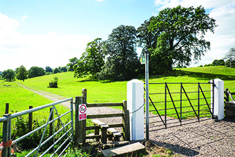
Cross Shrewsbury Road at the pedestrian lights near the Highwayman Public House. After a few metres turn left into Maesbury Road and almost immediately cross the road into Travis Perkins Builders’ Merchants. Go straight ahead and through two gates divided by the railway line (currently disused) and through the gate on the other side to enter a field. Head across field to a kissing gate 50 metres from the right hand corner of the field. In wet conditions you may prefer to follow the right edge of the field alongside cemetery. Go through kissing gate into a green lane and turn left. This is part of Wat’s Dyke Way. Continue along the lane to kissing gate onto road (Weston Lane).
4
Cross road diagonally right and take stile into field on left. Follow hedge on the right round the corner and then cross the field diagonally left to walk alongside the river Morda. Go through gap between the hedge and river and then go diagonally right to a kissing gate to the right of houses. Go through the gate onto a rough lane and turn right. Continue up the lane to the B5069 (Morda Bank). Cross straight over and through the kissing gate; now continue straight ahead on a good track past a house on the right, then over a grass field to a kissing gate. Go through the gate and turn left into Love Lane. At the end of Love Lane turn left at the fingerpost onto a tarmac lane (Croeswylan Lane) and continue for about 50 metres. Where the lane turns sharp left, cross the stile on the right and continue straight up the field to a stile at the top. Go over the stile into Penylan Lane and turn left, continue on the lane for about 100 metres and just past the house on the right take the stile up the bank on the right. Now head slightly diagonally left towards a metal gate that will become visible once you reach the top of the slope. Go through the gate and head across the field to a kissing gate (that should be visible). Go through the gate onto Trefonen Road.
5
At the exit onto Trefonen Road cross over, turn left and in just a few metres turn right (road signposted to Racecourse). Go along this road for 350 metres passing a road signposted for Candy on the left. Approximately 60 metres after the road for Candy go over the stile on the left and follow the broad track through Llanforda Estate. The track will start to bear right uphill as it approaches the field boundary. Continue along the track and go straight ahead under power lines to a stile into the woods. Continue ahead to a waymarker post in the centre of the wood then turn left and continue on the track though the woods ignoring the track that forks off right. At the kissing gate alongside Llanforda Gardens (ruin) (A) go ahead into the field and head directly across to a gateway opening in a stone wall. Go through the opening and head for a gate in the top right hand corner of the field, ignoring a gateway into the woods lower down. Go through the top gate and turn right along the field boundary (with the wood and hedge on your right). At the corner of the field, turn left and continue to follow the field boundary to the top of the field where you will encounter a stile onto a track.
(A) An internet search tells us that Llanforda Hall, was a home of the Williams-Wynn family but burned down in 1780. It was rebuilt in the 19th century but fell to ruin and was auctioned for demolition in 1948. The ruins of the walled gardens are all that now remain.
6
Cross the stile and track and then the stile opposite into the field. Head straight across the field towards a stile heading into a wood. Cross this stile and the small footbridge, then go straight ahead through the wood to another small footbridge and stile into a field. Follow the field boundary straight ahead for about 150 metres to a stile in the fence on your right. Go over the stile and another small footbridge into a field. Head diagonally left across the field aiming slightly to the left of the modern red brick house (Bwlch) you will see in the distance. As you cross the top of the slope in the field you will see some older cottages to the left of the modern house; start to head towards these. Near the edge of the field, cross the stile (alongside a gate) onto a track and then go directly through the gate into the grounds of the cottages. Head diagonally past the entrance to the cottages up to the road (cattle grid at road entrance).
7
Take the stile opposite the entrance to the road and go up past the barn with the barn on your right, over another stile and the hedge on your left. Keep heading up the field and past the now defunct stile where a fence has been removed. After a further 50 metres cross another stile and keep straight ahead with a wood on your left. After another 50 metres you will encounter a dry stone wall with a kissing gate on your left into the wood.Go through the gate, then go straight ahead through the wood down through the avenue of the trees until you encounter a broad track (Offa’s Dyke Path – signed with an acorn). Turn right and head up to a kissing gate onto the Racecourse. (B) Continue ahead passing the Janus horse sculpture and the ruins of the grandstand, crossing several access roads until you reach the B4580.
(B) The hilltop formed the Oswestry Racecourse where the English and Welsh squirearchy held an annual race week from early in the 1700s until 1848. Before the races the road that separated the north and south commons was barred to stop carriages and other vehicles from interfering with the running. Turf was laid over the road surface to prevent the horses from slipping. Most of the famous families from the Oswestry area were involved in the races during the Racecourse’s history, including ‘Mad Jack Mytton’. The main event was the Sir Watkin Williams Wynn Cup. The race was normally two circuits of the figure of eight course (4 miles). This was accompanied by ‘much drinking, betting, begging and picking of pockets’. The race week included many other social events in and around Oswestry. Spectators sat in the grandstand, the remains of which can be seen, or on the banks that surrounded the track.
8
Taking care, cross the B4580 (note that this is a busy road with fast moving traffic). Go straight onto the Racecourse Common, at this point you leave the Offa’s Dyke Path and take the right hand broad track. Continue ahead bearing right round the edge of the Racecourse Common until you reach a waymarked path bearing off to the right at the top of the common. Take this path through the woods for about 25 metres to emerge onto a broad track. Follow the track passing a house (Wood Villa) on your right then take the stile on the right into a wood. Continue on the obvious path down through the wood until you encounter a forest track. The path you are following now continues on downwards through woodland. Go through the gate at the bottom of the woodland to enter a field. Continue straight ahead, aiming just to the left of a farm building (Coppice Farm) in a small copse, to a stile into the next field. Cross the stile and continue ahead to a short track ending in a gate and stile.
9
Go over the stile into a lane and turn right to head down a rough track (signposted unsuitable for motor vehicles). Continue down the track for approximately 300 metres until you reach a waymarked path on the right. Go through the gate within a gate to enter a field. Keeping the field edge on your left continue until you reach a stile into a wood. Cross the stile and follow the path through the wood keeping to the left at a junction of paths, to reach a road. Now turn right and head up the road for approximately 350 metres, until you reach the wide entrance for Brogyntyn Park Farm on your left.
10
Turn left and enter Brogyntyn Park Farm; follow the farm track passing the dilapidated Brogyntyn farm buildings and a pond on your right to reach a gate. Go through the gate and continue ahead until you see a waymark post directing you to a gate on the left through the woods. Follow the path through the wood until it emerges through a gate onto a tarmac driveway. Brogyntyn Hall (C) is in view on your right. Follow the drive until it reaches the road (the B4579).
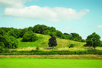
(C) Brogyntyn was a residence of members of the princely dynasty of the Welsh kingdom of Powys in late medieval Wales. It subsequently came into the possession of the Ormsby-Gore family (Lord Harlech). Apart from the Hall and parkland which are self-evident on this section of the walk, there are the remains of a medieval castle mound.
11
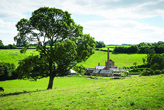
At the road at the exit from Brogyntyn Park, cross diagonally left to enter the driveway to Pentre Pant. Now go ahead to pass the entrance to Pentre Pant Hall on your left, continue ahead as the track becomes rougher and climbs up hill. As the track flattens out and just where the wall on the left has a wooden fence on top of it, you will find a narrow gap in the wall (on the left) with metal rails across it. Take this, the entrance to the footpath and go ahead for a short distance to a stile you can see ahead. Cross the stile and bear right across the field to a kissing gate in the top right hand corner, just a few metres to the right of a water trough. Go through the gate into the field on the right and then go left to follow the hedge line. When the hedge veers away to the left, continue ahead bearing slightly diagonally left aiming for a bend in the hedge and then follow the hedge to the bottom left-hand corner of the field and a wooden bridge. Cross the bridge and then go slightly diagonally left to a stile you can see ahead. Cross the stile and head across the field aiming for the wooden electricity pole you can see in the middle of the field; then go ahead to the stile you can see and cross into the lane.
12
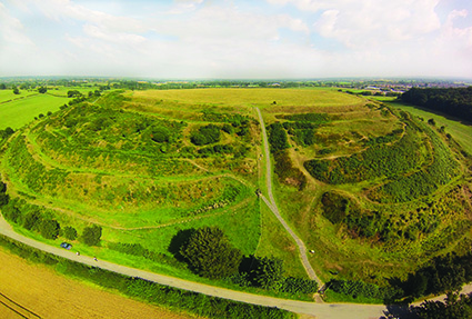
Turn right and go along the lane until just past a turning on the right and just before the lane swings sharp left. You will now find a stile in the hedge on your right, cross it and go a few metres to another stile into a wood. Go straight ahead along the edge of the wood to a stile into a field. Cross this stile and follow the hedge on the left heading diagonally left to a further stile into another field. Cross this stile and continue diagonally to a hedge corner and then follow the hedge on the left. Continue to head diagonally left (the last section of this path is alongside the hedge) to a stile onto a lane. Now turn right and head along the lane for a short distance towards a farm. Just as you reach the farm you will see ahead a stile (waymarked Wat’s Dyke) into a field. Cross the stile and head slightly diagonally right to a stile into the next field. Go through the gate and go along the field edge with the hedge/ fence on your left. As you cross the rise in the field Oswestry Old Hillfort (D) will come into full view. Continue ahead to a stile into the next field, follow the hedge line until it swings away to the left at which point you should head diagonally right to reach the field boundary at the bottom of the hillfort by a waymark post. Continue along the bottom of the hillfort to reach a metal gate leading onto a lane.
(D) Oswestry Iron Age Hillfort remains one of the best preserved hillforts in the UK, according to English Heritage. Built on lower ground, it is also one of the most accessible hill forts with stunning panoramic views across North Wales, Cheshire and Shropshire. Designated in 1934 as a scheduled monument (number 1014899) it is in the guardianship of English Heritage. After the Hillfort was abandoned it was incorporated into Wat’s Dyke, and two sections of this are adjacent to it. For more information visit the English Heritage website.
13
Go through the gate, turn left and go along the lane for about 100 metres to a metal kissing gate at the back of an informal car parking area on the right. Go through the gate and go diagonally left over the field to a kissing gate (there is currently no gate here). Go through the kissing gate and turn left to follow a short path (between a hedge and a fence) to exit onto a car park. Go across the car park to the exit and go straight ahead along Gatacre Avenue. At the bottom of Gatacre Avenue cross the road into Gatacre Road. At the bottom of Gatacre Road cross the road to enter the small car park; go straight ahead to the exit and then continue ahead along Lloyd Street. At the end of Lloyd Street, cross straight over into Swan Lane. Go down Swan Lane to the bottom and cross the road to reach Oswestry Bus Station.

