1
From your chosen car park (Whiting Way or Tucker Street), make your way to the Marketplace, via the High Street and at the far end, pass through the archway.Turn right, walking with the moat to your left and going left with it at the next corner. Continue to metal barriers and cross the road beyond. Turn right, then immediately left into Torhill Lane and walk for a few yards before taking stone steps up to the right. Now climb into the woodland on a clear path to reach a gate. Proceed ahead to open grassland then continue, climbing gently, and re-entering woodland. The well-defined path bears left and leads you to a gate, go through and walk down the meadow ahead, keeping to the right boundary. At the far end, turn right, then left, now walking alongside the left boundary towards a farmhouse. As you near the house, veer right to the far corner of the field where you will find a stone stile; cross to a track.
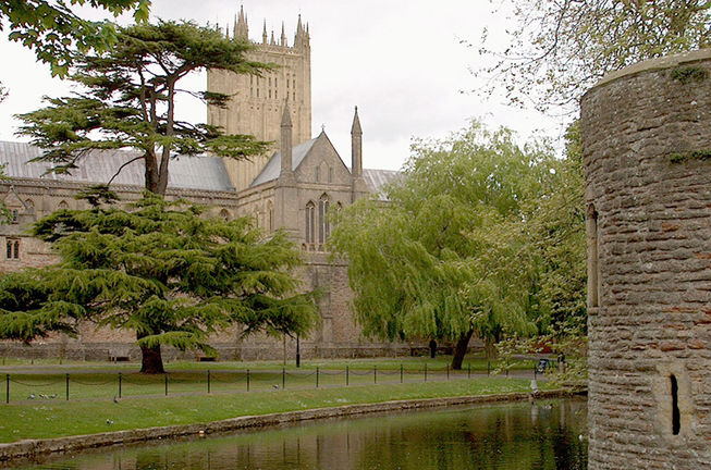
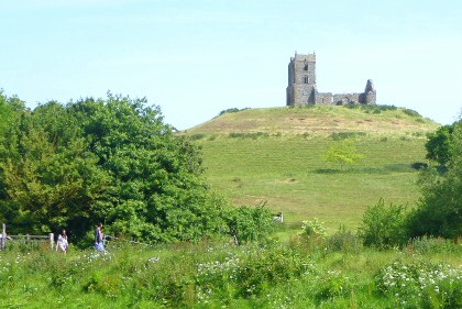
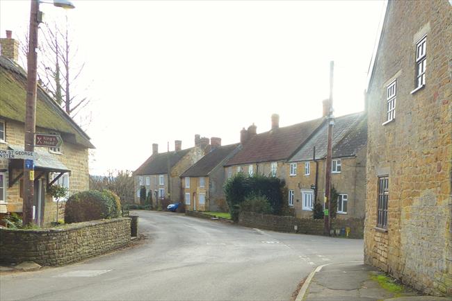
(A) This 15th century gatehouse leading off the Marketplace is called the ‘Bishop’s Eye’. On passing through, you reach the moated Bishop’s Palace, contained within a 14th century wall of battlements and towers. This is the seat of the Bishop of Bath & Wells and is famous for its swans that twice daily ring the bell beside the drawbridge for food. The springs that gave the town its name were located beyond the bridge spanning the moat; famous even in Roman times, they produced prodigious amounts of water.
2
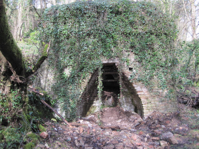
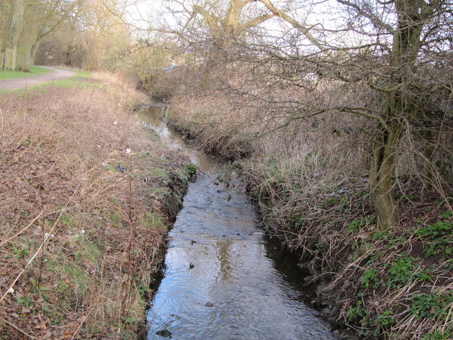
Walk left passing the farm buildings and turning left immediately beyond. Now go ahead to climb a stile by a gate, with a golf course to your right. Follow the boundary path around the course, going right at the first corner, but before reaching the next (a left bend) take the waymarked path left, into woodland, and walk with a wire fence to your left. Steps lead you down to a wooden stile, beyond which, follow the path left with a sports field to your right, then going right to arrive at a broad, stone stile beyond a stream. Don’t cross the stile, but instead turn right and walk with the stream (or ditch, depending on the weather) on the left, playing field right and continue in the same direction on a cycle path leading toward the houses. The path bears right then curves left, eventually bringing you to a gate that you pass through to a main road. Cross to a metal field gate on the far side, go through, then immediately turn right through a waymarked gate. Now turn left and follow the path into woodland. You now have a gentle climb of almost two miles, through woods carpeted with bluebells and wild garlic in springtime, but so attractive at any time of year that you will only notice the ascent for the last few hundred yards!Follow the broad path, passing an old limekiln on the left. The path degenerates to a narrow, partly grassed route and you continue, eventually crossing a dry stream bed and proceeding in the same direction with the stream on your right.
NOTE: The path up to Beryl Wood and through Biddle Combe is very overgrown in places with some fallen trees. Sections may be flooded after heavy rain and the stones can be very slippery. THIS CAN BE HAZARDOUS. Take great care on this section and do not attempt if conditions are bad or you do not feel confident.
3
When you reach cross-paths with a stone bridge on the right keep on ahead for almost three-quarters of a mile, passing another cross-path and bridge to the right, to reach a further junction, just beyond a circular stone structure down to the right. You need to take care here! Descend right, crossing a brook that runs into the stream you've been following. Turn left with the brook on your left, ignore the stile passed immediately on the right, but continue to a metal field gate ahead. Beyond this, the route becomes steeper and rougher, eventually reaching another gate. Go through and keep to the left boundary with open fields to the right, passing through a gate to reach a road.
4
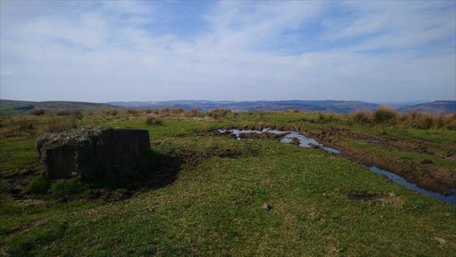
Cross the road with care half-right and climb the stone stile, then head across the hill, keeping in touch with the right boundary until you reach a gate in the cross-fence and walk past one of the supporting cables for the mast (B).On reaching the field corner, climb the stone stile and turn left, then follow the field boundary around three sides, eventually crossing another stone stile on your left. In this next field, walk with the stone wall on your left, passing into another field and continuing to reach a road.
(B) The television mast 1000 ft high and located at one of the highest points in the Mendip Hills, began transmitting in December 1968. The West services of BBC and ITV are broadcast from this site.
Instead of climbing the stone stile as mentioned above, follow the right field boundary to a gate adjacent to the road. Follow directions from [5]. Note: This route is not shown on the OS map but a footpath finger post has been erected at the gate adjacent to the road.
5
Turn left and follow the road, ignoring a footpath right, then as the road starts to descend and bear right, take the track on the right, marked as a byway. With woodland on your left, pass Durston Drove Farm on the right and continue beyond Rookham Farm to a fork in the track. Go left to Rookham View, passing a mast on your right. Follow the track until it bears right and crosses a cattle grid; here, strike out half-left across the field to reach an old hawthorn hedge boundary with farm buildings beyond. Walk now with the farm on the right to reach a waymarked gate. Go through and walk up the hill, aiming for the highest point until a field gate and stile come into view in the cross-fence. Beyond, keep on in the same direction across the field to climb a stile by a gate in the far hedge. Now go ahead, boundary right, to the far corner of the field and a path junction. Turn left here, and keep the boundary on your right as you go steeply down the hill. At the bottom, climb the stile and go ahead to another in the far boundary. Once over, head straight down the field and pass through the boundary hedge. Continue down to a further stile, then in this final field go ahead to pick up a cross-path. Follow it right to a gate, then take the road, School Hill, down to a bus stop at a road junction.There is a café beyond the car park that you may wish to patronise, otherwise, continue the walk from the bus stop. Take the stepped, surfaced path on the left up the hill, and go through a kissing gate. Now climb a stile to enter a field and walk ahead with the hedge on your right to a metal stile. Climb over and follow the track ahead to a farm, where you go through a metal gate on the right and descend to a lane. Turn left and follow the lane as it bears right, walking past a ruined cottage on the left, beyond which there is a footpath left and driveway right. Ignore both these options, but a short distance further, climb a stile in the hedge on the right.
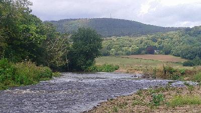
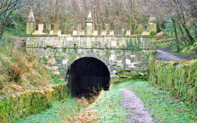
(C) To your left is the Wookey paper mill with show caves beyond. The ancient craft of making paper by hand originated in China around 105 A.D., reaching England towards the end of the 15th Century. The first record of a paper mill at Wookey appeared in 1610, the River Axe powering the mill. For almost 400 years skilled craftsmen have been producing fine quality handmade paper at Wookey Hole with production reaching a peak in the early 1900s. Then the mill employed over 200 men and women producing bank notes and security papers for a worldwide market.
6
You are now in a camping field, walk diagonally down to a gate in the lower left corner. Go through and walk ahead, picking up the right boundary and keeping close to it, soon reaching a metal kissing gate. Beyond, cross the stream then head up to the top right corner of the field where you go through a wooden gate to the right of the farm buildings. Now walk with the fence on your left, metal sheds beyond, then strike out across the field to the far right corner where you go through a kissing gate to a track that you follow for a short distance to join a lane. Continue in the same direction until the lane bears left and here, go ahead along a track then through a wooden kissing gate.
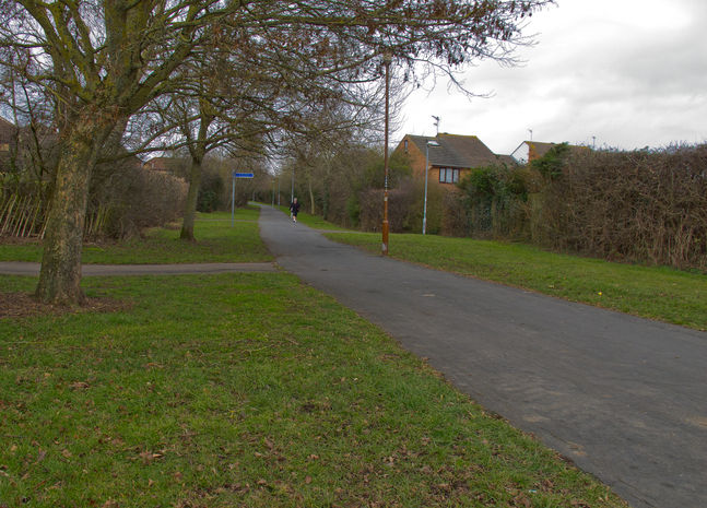
7
Follow the tarmac path, crossing a residential road and continuing to a second. Here, cross slightly left and take the path down the side of ‘Coopers Close’. At the far end, you enter school grounds, walk straight ahead passing the reception building on the right, and keeping to the path as it takes you over a road bridge. At the far side, turn right and follow the path back to your car park or the bus stop.