The Cambrian Way
A spectacular 298-mile route from Cardiff to Conwy taking in Yr Wyddfa (Snowdon) and many other Welsh mountains
The spectacular Cambrian Way long-distance walking route runs 298 miles from Cardiff in south Wales to Conwy in north Wales. It passes through some of Wales’ most beautiful, remote, and rugged terrain taking in some of Wales’ highest mountains, including Yr Wydffa (Snowdon).
The Cambrian Way has a challenging 22,500m (73,700ft) of ascent and takes around three weeks to walk. Many short sections can be explored without the need to take on the full route.
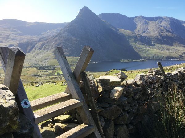
There are also plenty of high ridges, rugged, cragged, and challenging mountains in the north. A big part of the route runs through two national parks – Bannau Brycheiniog (Brecon Beacons) and Eyri (Snowdonia) – as well as designated 'wilderness' areas in Wales.
Tempting as it may be, the entire Cambrian Way should not be the first outing attempted by the novice walker. Much of the route is in open access country, for which you need good navigational skills. Some sections are long and remote, and accommodation can be basic. Although the mountains are not high at around 1000m, they are challenging. They are often remote and suitable for people with a good amount of mountain walking experience.
The Route
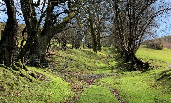
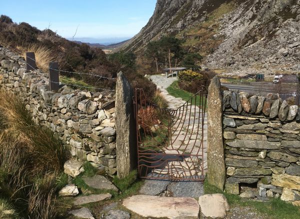
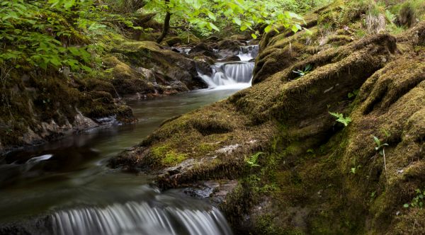
The Cambrian Way starts at the capital of Wales in Cardiff. It runs from Cardiff Castle in the city centre and ends at Conwy, the mighty northern fortress of a town. A lot of beautiful countryside, with steep valleys, streams, rivers, waterfalls and hills run between them.
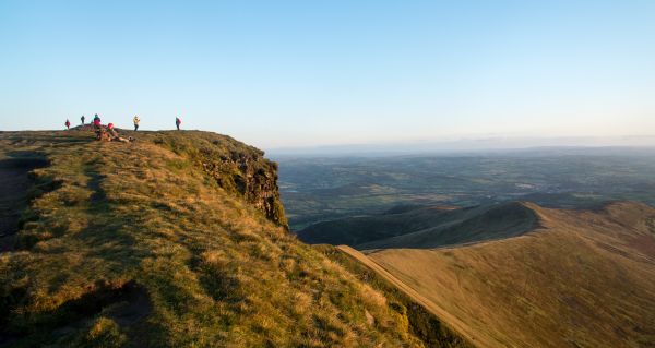
After leaving the city it passes through Bannau Brycheiniog (the Brecon Beacons National Park), traversing the iconic Pen y Fan mountain. It then leads through the Carmarthen Fans with their legendary Llyn y Fan Fach lake. Beyond Llandovery, the countryside is remote and wild as the route enters the Elenydd region and crosses Pumlumon. There is a challenging traverse of Cadair Idris, and a brief glimpse of the sea when crossing the Barmouth viaduct. A stiff ascent leads to Rhinog Fach and Rhinog Fawr where there are views north to Yr Wydffa (Snowdon). The route ends with a descent to the coast at Conwy Castle.
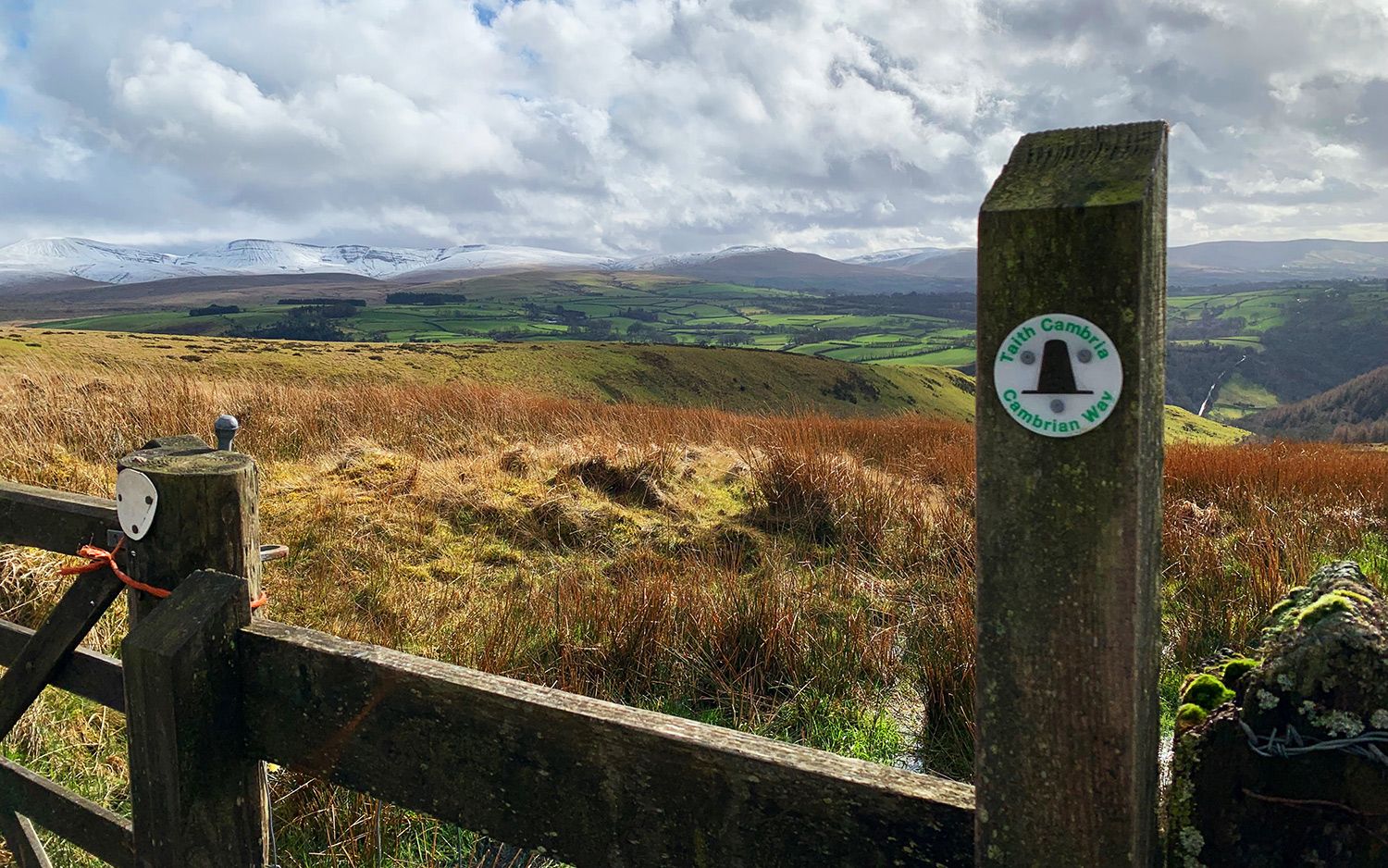
Much of the Cambrian Way is waymarked with the Welsh hat symbol or on marked public rights of way. Large parts of it are over open access country and mountain ridges and peaks where paths are not always clear. Often there can be a confusion of paths, many of which may be sheep tracks. For these reasons it is necessary to have good map-reading skills, particularly if visibility is bad.
Accommodation
There is a wide range of accommodation on the Cambrian Way. This includes youth hostels, bunkhouses, bothies, campsites and bed-and-breakfasts as well as hotels. Wild camping in Wales is only allowed with the landowner’s permission. There is a detailed accommodation list on the Cambrian Way website.
With often quite long distances between accommodation it is unwise to arrive without booking in advance. It is safest to book for the part of the route you’re walking before setting off so that you can be assured of a bed for the night.
Creating the trail
In the 1960s a small group of Ramblers members decided to plan a south-north national trail running through the upland areas of Wales. Although they didn’t manage to come up with an agreement, one of the members, Tony Drake, decided to go ahead and create the route, most of which is still the official route today. Without him and his passion for wild Wales, the project would have failed.
The Cambrian Way Trust and Ramblers Cambrian Way Working Group now take care of the trail.
Recent Ramblers work on the trail
In March 2020, Ramblers Cymru staff, volunteers and partners completed the waymarking of the entire route. The markers are there as a reassuring guide and shouldn’t be relied upon on their own to or show the route.
Much of this work was made possible with the support of players of the People’s Postcode Lottery.. Work is also in progress to get the route added to OS maps.
Taking on the challenge
Whether you want to take on the full route or find inspiration about a section near you, there are a range of resources available.
Get a copy of the Cicerone official Cambrian Way guidebook.
Visit the Cambrian Way Trust’s website for more detailed information and to search for accommodation on the route.
Listen to the Cicerone podcast about the Cambrian Way.

Wales Coast Path
Opened in 2012, the stunning Wales Coast Path runs for 870 miles. It offers brilliant walks whether you are seeking a challenge or a leisurely stroll.
.jpg?itok=UJB9xm6p)
Ramblers Cymru launch partnership with Transport for Wales
Transport for Wales and Ramblers Cymru launch a partnership project to get more people using public transport to access local walking routes.
Britain’s Best Walks – Wales
From epic mountain walks, beautiful coastal strolls and a much treasured National Trail, check out which of our routes in Wales made the top 100.