Finding historic maps online
Sources of local and national maps available online.

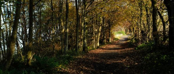
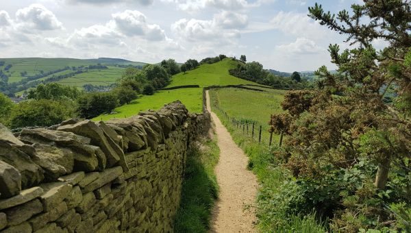
The Ramblers Don’t Lose Your Way project identified over 49,000 miles of potential lost paths. Hundreds of volunteers are now working to protect these historic paths to safeguard our right to access to them for the future. Rights of way can be claimed based on historic or documentary evidence that shows a public right of way was established in the past. Its existence may have been forgotten or incorrectly recorded but public rights of way do not expire just because no one remembers them.
Claiming a right of way based on historic evidence
Saving a lost path may require undertaking historical research at archives, libraries and parish councils. Or you may need to get out and about in the community to gain evidence of use by the public. However, many of the evidence sources you need can also be found online, meaning you can conduct parts of your research from the comfort of your own home.
Finding sources of historical information online
Online sources of National information
National historic mapping information
The following pages are all useful sources of evidence that can be viewed online. Some, like the National Archives, have both online collections and collections which you will need to view in person. For more information, please consult their catalogue.
National Library of Scotland
A collection of UK-wide maps including fully georeferenced OS maps and Bartholomew's "Half Inch to the Mile Maps" of England and Wales. Particularly useful are the very detailed OS County Series 25” England & Wales maps.
National Library of Wales
The National Library of Wales has a large selection of Welsh tithe maps and apportionments that can be viewed online, as well as other potentially useful resources.
The National Archives
The National Archives do not have extensive digitised map collections but their catalogue will give you a good idea where other documents are stored (in the National Archives and locally). Their website also has some useful guides on how to conduct your research and interpret certain types of documents.
The British Library
The British Library holds geo-referenced maps.
WikiCommons
WikiCommons has a digitised collection of the original preliminary drawings made by the OS surveyors between the 1780s and 1840
Old Maps Online
OldMapsOnline.org draws from several archive collections and has maps searchable by place.
The Bodleian Library
A substantial number of the Ordnance Survey Area Books are available for English and Welsh counties.
The Genealogist
This website has digitised Tithe Maps for England and Wales. A paid subscription is required, to which Ramblers volunteers have access (ask your team coordinator for details).
Vision of Britain
This website holds maps including 1st Edition OS Old Series maps and several UK wide maps. It also includes historical accounts of travellers.
Catalogue of Enclosure Maps
Whilst it doesn't hold the digitised maps, this site has a detailed catalogue of all the enclosure maps across England and Wales from 1595-1918. In most cases, you will need to visit the National Archives to view the maps.
National Library of Australia
The National Library of Australia has a complete set of the 1st Edition OS Old Series maps that can be found through the interactive map index . It also has other digitised maps of the United Kingdom (found through the search functionality).
The University of Cambridge library
Mainly focused on Cambridgeshire but also some other counties (including Kent and Suffolk), this library has digitised maps including estate, parish and enclosure maps.
The David Rumsey Map Collection
A series of 1st Edition Ordnance Survey maps as well as county maps.
New Popular Edition Maps
The New Popular Edition of the OS map primarily from the 1940s.
Mapco
Historical maps of the British Isles.
Sabre Roads
Old road maps of Great Britain
Maps for sale
There are lots of websites with maps for sale. Examples include pastpages.co.uk, antiquemaps.com, jpmaps.co.uk, lindisfarneprints.com, antique-prints-maps.com, copperplate.co.uk, gillmark.com, rareoldprints.com and ebay.co.uk
Online sources of other national historical information
Historic England
A large range of photographs, plans and drawings of England’s buildings and historic sites.
The Royal Commission on the Historical Monuments of England (RCHME)
The plates at the end of The RCHME Inventory Volumes often feature maps which may be useful in research. The same website also hosts online reproductions of the Victoria County History which includes descriptions of settlements.
The Mills Archive
A database of mills in the UK which may be helpful if a potential lost right of way passes near a mill.
Picture Archives
Picture archives may yield historical evidence that a path was used by the public. Examples include: historic-newspapers.co.uk, Historic England’s archive and the London Picture Archive.
Aerial photographs
The Historic England Aerial Photo Explorer, BritainFromAbove.org.uk and CambridgeAirPhotos.com hold extensive collections of aerial photographs.
Local History Groups
The British Association for Local History and Local History Online have directories of local history groups across the country.
Online sources of modern-day mapping information
Land Registry
The Land Registry’s INSPIRE mapping is the easiest place to first see if parcels of land are registered. The British Horse Society have produced a short helpful video about using the INSPIRE site. Searches for individual properties can then be made on the Land Registry website.
Bing Maps
The current OS map is available on desktop browsers. To access it, in the top right corner, change “Road” to “Ordnance Survey” and zoom in to get greatest detail.
Rowmaps.com
This site has a map of rights of way created using data supplied by some but not all local authorities.
Geograph
This site has geolocated user uploaded pictures from the last ten years as well as useful historical information.
Online sources of local information
There are a wide range of local sources of digitised maps. We are aware of the following sources:
England
Bath and North East Somerset
The Know Your Place website for Bath and North East Somerset has maps including Tithe Maps (limited coverage) and town plans (select Basemaps to see all available maps). Freshford.com includes links to maps focused on the villages of Freshford and Hinton Charterhouse. History Map Bath has maps available primarily from the 19th and early 20th centuries.
Bedfordshire
Bedford Borough Council has a full set of maps related to the Rating and Valuation Act 1925. There are many maps (including Tithes and Enclosures) available from the Bedfordshire archives.
Berkshire
The Berkshire Record Office hosts a full set of the enclosure maps for Berkshire. Mapco.net has an 1856 A Map Of Windsor Forest And Its Vicinity by Henry Walter. Oxford University Library has early maps of Berkshire and the enclosure map for the parish of Dachet is available. An estate map for the Goodrest Estate situated in Shinfield is available from Reading Library.
Bristol
The Know Your Place website for Bristol has Tithe Maps, town plans and early aerial photographs (select Basemaps to see all available maps). Coaley.net has early county maps for Gloucestershire including Bristol.
Buckinghamshire
Oxford University Library has early maps of Buckinghamshire . Also available is the enclosure map and associated act of parliament for the parish of Sherington.
Cambridgeshire
The Cambridgeshire Community Archive Network has links to a large range of documentary sources including maps. There is an estate plan centered on the village of Carlton. Information on the villages of Hinton, Orwell and Meldreth is also available on local history websites.
Cheshire
Tithe Maps, and transcribed apportionments, are available from Cheshire Archives & Local Studies. The Historic Society of Lancashire and Cheshire have a digitised and searchable collection of their Transactions going back to 1849. The National Library of Scotland has some county maps of Cheshire . There are also historic maps of the city of Chester and some maps focused on the village of Christleton.
County Durham
Tithe Maps and apportionments for County Durham are available from Durham University. Picturesinprint has maps, including early modern strip road maps (search “map” or by place name). Lakes Guides Maps have county maps of County Durham (under "adjacent counties"). The National Library of Scotland has some county maps of Durham .
Cumbria
Cumbriaimagebank.org.uk has early county maps and town plans. Lakeguides.co.uk has a lot of maps of the Lake District and surrounding historic counties. Cumbria Past’s maps of the Great and Little Stainton, Newbiggin and Blencow areas of the Barony of Greystock Enclosure Award (1775) and the Cumbria Archive Catalogue Service may be useful. The National Library of Scotland has some county maps of Cumberland .
Derbyshire
The Derbyshire Heritage Mapping portal has historical maps (including tithe and enclosure maps) for the Derwent Valley. There are maps available focused on the village of Padfield and the town of Matlock. The tithe map for Bonsall and the tithe apportionments and a representation of the tithe maps for the parishes in the Lower Dove valley may be useful. The National Library of Scotland has some county maps of Derbyshire .
Devon
The Know Your Place website for Devon has maps including tithe maps, town plans and early aerial photographs (select Basemaps to see all available maps). The tithe maps (with apportionments) are available from Devon County Council. A map of the county from 1765 is also available.
Dorset
Dorset County Council have a county map from 1831 alongside various maps from the National Library of Scotland georeferenced. Dorsetshire.com has early county and area maps.
East Riding of Yorkshire
Maps focused on the parish of Pocklington are available online (best accessed through the search functionality). Lakes Guides Maps have county maps of Yorkshire available (under "adjacent counties").
East Sussex
East Sussex County Council have digitised copies of the Tithe Maps for East Sussex and Brighton & Hove. Mybrightonandhove.org.uk and brightonhistory.org.uk host some town plans. Brighton Museum’s online collection has a small number of digitised documents which may be of interest. Oldsussexmapped has county maps.
Essex
Essex County Council has maps including some Tithe and Enclosure maps (select “Images” under “Refine Your Search”). Oldessexmaps.co.uk has county maps from the 16th century to present day. There are several maps focused on the village of Foxearth and surrounding areas. Mudge’s survey of Kent (c1801) includes some of the southern part of Essex. A Reproduction of a Map of the County of Essex (1777) by John Chapman & Peter André is also available.
Gloucestershire
The Know Your Place website for Gloucestershire has maps including Tithe Maps, enclosure maps, and town plans (select Basemaps to see all available maps). Coaley.net has early county maps for Gloucestershire. Glos1909survey.org.uk has the 1910 Finance Act maps. A town plan and the enclosure map for Tewkesbury is available.
Greater London
Faden’s topographical map of London (c1800) gives an oversight of London and its surrounding areas. Groom's New Map Of Middlesex (c1883) includes many Outer North London Boroughs. The North Mymms History Project has made available a 1900 footpath map which includes parts of Barnet. Some outer London areas can be seen on historical maps of neigbouring counties. For example, Waltham Forest and Barking & Dagenham can be seen in the south-west corner of this 1777 map of Essex.
Greater Manchester
The University of Manchester has several maps of the city and surrounding areas.
Hampshire
Old Hampshire Mapped has Hampshire county maps. The North Hampshire Tithe Map project has a collection of maps digitised for the Borough of Basingstoke and Deane. Oxford University Library has maps related to the estate of Foxcotte Manor near Andover. The 1870 OS Town Plan for Southampton is available .
Herefordshire
Herefordshirehistory.org.uk has county maps of Herefordshire. Maps related to the south west of Herefordshire are available including enclosure maps, areas maps and estate maps.
Hertfordshire
Faden’s Topographical Map Of The Country Twenty Miles Round London (c1800) and Groom's New Map Of Middlesex (c1883) both include parts of Hertfordshire. Hertfordshire-genealogy have extracts (of varying quality) from several county maps. The North Mymms History Project includes a 1900 footpath map of the area and some sales documents. Maps, including the enclosure map, for the village of Pirton are available.
Isle of Wight
Old Hampshire Mapped has county maps some of which include the Isle of Wight.
Kent
Mapco.net has Mudge’s survey of Kent (1801) and the North West Kent area of Faden’s Topographical Map Of The Country Twenty Miles Round London (1789).Kent County Council’s heritage map has aerial photography (from 1990 and 1946) and Ordnance Survey County Series maps. The Tithe map for the parish of Saltwood and historical info on the village of Pembury are available.
Lancashire
Lancashire County Council has county maps and early OS maps and Lancaster University has historic maps of the city. The tithe map is available for the parish of Tatham. The Historic Society of Lancashire and Cheshire have digitised and made searchable Transactions going back to 1849 . The National Library of Scotland has some county maps of Lancashire .
Leicestershire
Estate plans related to the Rothley Temple Estate and county maps are available from the University of Leicester. The tithe map for the village of Enderby is also available.
Lincolnshire
Lincs to the Past has some tithe maps and some working copies of the 1910 Finance Act maps (once searched click images to see all digitised sources). The National Library of Scotland has some county maps of Lincolnshire .
Merseyside
There are maps of Liverpool available from historic-liverpool.co.uk.
Norfolk
Norfolk County Council has tithe and enclosure maps . The council also has several useful maps setting out the historical divisions of Norfolk . Faden’s Map of Norfolk (1797) and the enclosure map for Martham are available.
North Somerset
The Know Your Place website has maps including tithe maps (limited coverage) and town plans (select Basemaps to see all available maps). Freshford.com includes links to maps focused on Bath and the Somerset villages of Freshford and Hinton Charterhouse. History Map Bath has maps available primarily from the 19th and early 20th centuries.
North Yorkshire
The National Farm Survey (and others maps, sorted by settlement) for the area around Malham are available. Lakes Guides Maps have county maps of Yorkshire available (under "adjacent counties").
Northamptonshire
The Spratton Local History Society have an extensive photographic archive focused on the parish which includes a large number of maps (mainly estate and sales maps).
Northumberland
The Northumberland Communities website has extracts of historical maps including tithe maps (and awards), 1910 Finance Act Maps and Estate plans (once on the relevant community page click “Plans” in the left hand bar to find maps). Lakes Guides Maps have county maps of Northumberland (under “adjacent counties”). The National Library of Scotland has some county maps of Northumberland.
Nottinghamshire
Nottshistory.org.uk has county maps and town plans for Nottinghamshire. Oxford University Library has early maps related to the parish of Laxton. The National Library of Scotland has some county maps of Nottinghamshire.
Oxfordshire
Oxfordshire County Council has the 1910 Finance Act maps (and valuation books), the Tithe maps, and city, town, village and county maps. Smith's New Map Of The County Of Oxford (1801) is available on Mapco.net. Oxford University Library has early maps of Oxford and Oxfordshire. Picture Oxon has a historical photo collection of 100,000 images of the county. The Bicester Local History Society has early maps of the town. Maps (including enclosure and tithe maps) focused on the village of Charney Bassett are available.
Shropshire
The Shropshire Archive has maps including some tithe maps. Shropshiremaps.org.uk also has a small number of maps as well as useful information about where to find maps locally. The tithe map (with apportionments) is available for the town of Broseley. There are maps available from Oswestry Borderland Heritage.
Somerset
The Know Your Place website for Somerset has maps including Tithe Maps, enclosure maps, and town plans (select Basemaps to see all available maps).
South Gloucestershire
The Know Your Place website for South Gloucestershire has maps including Tithe Maps, enclosure maps, and town plans (select Basemaps to see all available maps). Coaley.net has county maps for Gloucestershire. Glos1909survey.org.uk has the 1910 Finance Act maps available.
South Yorkshire
Picturesheffield.com has images and maps of Sheffield and the West Riding. Lakes Guides Maps have county maps of Yorkshire (under "adjacent counties"). There are several estate plans focused on the town of Conisborough. Barnsley Borough Council hosts several old OS maps.
Staffordshire
Staffspasttrack.org.uk has old OS maps and the 1775 Yates map as well as other maps including extracts from Tithe maps and awards. Local maps for the village of Gnosall (including Tithe maps and 1910 Finance Act maps) are available. Thepotteries.org has maps of Stoke-on-Trent and North Staffordshire. The Colton History Society has digitised a range of records related to the village including estate sales documents. The tithe apportionments and a representation of the tithe maps for the parishes in the Lower Dove valley (on the Staffordshire/Derbyshire border) are available .
Suffolk
Suffolk Record Office has the Moule (c1840) and Saxton (1575) maps online. There are maps focused on the district of St Edmundsbury and the village of Foxearth (on the Suffolk/Essex border) which include surrounding areas in the two counties.
Tyne and Wear
A few maps related to the parish of Hetton .are available.
Surrey
Mapco.net has an 1874 map of the county by Wyld and part of Surrey is on Faden’s Topographical Map Of The Country Twenty Miles Round London (1789). Local maps are available by searching the Surrey Archives catalogue (select “Image Available: Yes” in the advance search).
Warwickshire
Warwickshire Heritage and Culture has historic map layers available. Our Warwickshire has information for many communities containing photographs and maps. There are map extracts relating to Birmingham and Warwickshire published by West Midlands History. Windowsonwarwickshire has several maps in their online collection.
West Midlands
The Library of Birmingham has some maps including two tithe maps. There are some map extracts relating to Birmingham and Warwickshire published by West Midlands History. Historiccoventry.co.uk has several maps of the city and surrounding areas. Dudley Borough Council has old OS maps, early aerial photographs and Roper Maps (c1855) which can be viewed over present day maps.
West Sussex
Oldmapsonline has county maps. The Fernden Hill Estate sale and map is available as well as maps for the village of Tangmere.
West Yorkshire
Wakefield Council Libraries have made available a large range of photographs and a small number of maps . The tithe maps and apportionments for Bradford and Leeds districts are available from the West Yorkshire Archive Service. Lakes Guides Maps have county maps of Yorkshire. Calderdale Borough Council hosts old OS maps on their website. An 1852 Map of York, surveyed by Captain Tucker, is available from yorkmaps.net. The Kirklees Image Library has maps and Huddersfield.exposed has a large number of photographs and a small number of maps related to the town.
Wiltshire
The Know Your Place website for Wiltshire has maps including Tithe Maps, OS maps, and town plans (select Basemaps to see all available maps). Freshford.com includes links to maps including Bradford on Avon and the village of Limpley Stoke.
Worcestershire
Worcestershire County Council has a visual representation of the Tithe and Enclosure awards in the county. The 1910 Finance Act, Enclosure and National Farm Survey maps (and related records) for the villages of Badsey, Aldington and Wickhamford are online. The tithe map for the village of Harvington is available.
Wales
Tithe Maps, and the fully digitised and transcribed apportionments, are available from The National Library of Wales.
The North-East Wales Archive has digitised resources available, including enclosure maps and some quarter session records, for Denbighshire and Flintshire. Some of these are also available through the Deep Mapping Estate Archive project website. The Bangor Civic Society has maps available for the town (including Tithe Maps). Archer’s Map of Brecknockshire is available. Powys County Council have some digitised records including estate maps and some Quarter Sessions records.
Help us keep this list updated
If you know of other sources not listed or come across a broken link then please email dlyw@ramblers.zendesk.com.
Claiming unrecorded public rights of way
Unrecorded paths are vulnerable to development and unresolved problems. It is important they are claimed and get the protection they are entitled to.
A brief history of public rights of way
How our network of public rights of way came to be and why it is so important we protect these ancient routes.

The Definitive Map
The Definitive Map is an important legal record of public rights of way in England and Wales. But how and why did it come to exist?