The best walking routes up Scafell Pike
Our guide to planning a safe and enjoyable hike
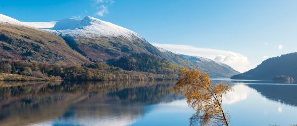
As the highest mountain in England, 978m Scafell Pike has obvious natural appeal. Like Ben Nevis and Yr Wydff (Snowdon), it draws many hikers looking to tick off the country’s biggest peaks.
That means walking up Scafell Pike will not be a solitary endeavour. Depending on the weather and the route you choose, you are likely to be joined by many others. That can make you feel part of something special. But it will also have a big impact on your walk, and on the mountain itself.
The number of hikers flocking to Scafell Pike has boomed since the Covid-19 pandemic. This puts local facilities, trails and mountain rescue teams under extreme pressure.
Not least because such popular routes give an air of false security. People assume Scafell Pike must be an easy stroll if so many people do it. But actually it’s a relentlessly steep, hard, rocky hike that should not be underestimated, especially in poor weather.
So should you climb England’s highest peak? Undeniably, it’s hard to resist. Summitting Scafell Pike is a satisfying achievement that rewards with impressive views and a great mountain experience. However, if you have time and are confident in your planning, consider alternatives to the crowded main path. Or look at different routes nearby, to avoid the crowds altogether.
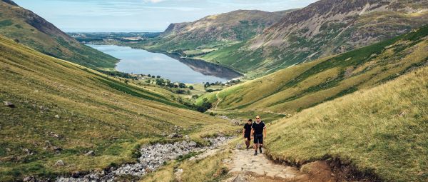
Scafell Pike from Wasdale - The well-trodden route, straight up, straight down
For those simply looking to bag Scafell Pike’s peak, then walking up from Wasdale is the obvious route. It’s steep but short compared to the other approaches. And very popular.
It’s a beautiful journey to access Wasdale itself, skirting lovely Wastwater. There are two car parks here, one pay-and-display National Trust with a toilet and one near the Wasdale Head pub. Try to arrive early to secure a spot. Even better, reach the trailhead via the seasonal shuttlebus. It runs from Ravenglass, Gosforth and Nether Wasdale to Wasdale Head on select weekends, May-September.
The start is well signposted up the ‘Brown Tongue’ path. It can get busy. Take time to let faster walkers pass and make sure you feel comfortable with your own pace and footing. You’ll want to stop often though. On a clear day you’ll get amazing views over Wastwater and beyond whenever you take your breath and turn around.
The route ends with a bit of a slog to the summit over rocky, uneven ground. It’s pretty steady going but not to be underestimated. Navigating is required, particularly in patchy weather
At the top, enjoy the views to Scafell and fells such as Great Gable. On a clear day you can see the Isle of Man. Also visit the large, round stone summit cairn and plaque. The whole summit of Scafell Pike is a memorial to the Lake District men killed during the First World War. Note, it’s easy to get disorientated up here in poor conditions and head off the hill into the wrong valley.
Most hikers descend the same way they came. This is the quickest option, making a round-trip of 5.5 miles, doable in around 3.5 hours. Have a drink at the excellent Wasdale Head Pub on your return.
Scafell Pike from Wasdale alternatives - The classic climb, with other ways down
It’s possible to extend your Scafell Pike hike by walking up the main path from Wasdale but choosing a different way down. Just be sure to allow time for an extended circular route. And, as with any hike on the mountain, only attempt these options if you feel confident in your abilities and navigation skills.
For instance, from the summit you could take a slight detour to descend over the grassy flanks of Lingmell. This is a great option, though steeper at times than Brown Tongue.
Another alternative is the path via Sty Head, along the Corridor Route, an ancient packhorse trail. This joins the top of the Brown Tongue path just past Lingmell Col. Linking this with the classic Wasdale trail provides a great circular option. Just be aware that it’s longer and a little more challenging in terms of terrain and route-finding. It’s easy to take a wrong turn near Lingmell Col when coming down and miss the Corridor.
A truly fantastic but advanced outing is a 10-mile loop from Wasdale to Lingmell, then Scafell Pike, Broad Crag and Great End. Great Gable could be added too, time and good weather permitting, extending the walk to 11 miles.

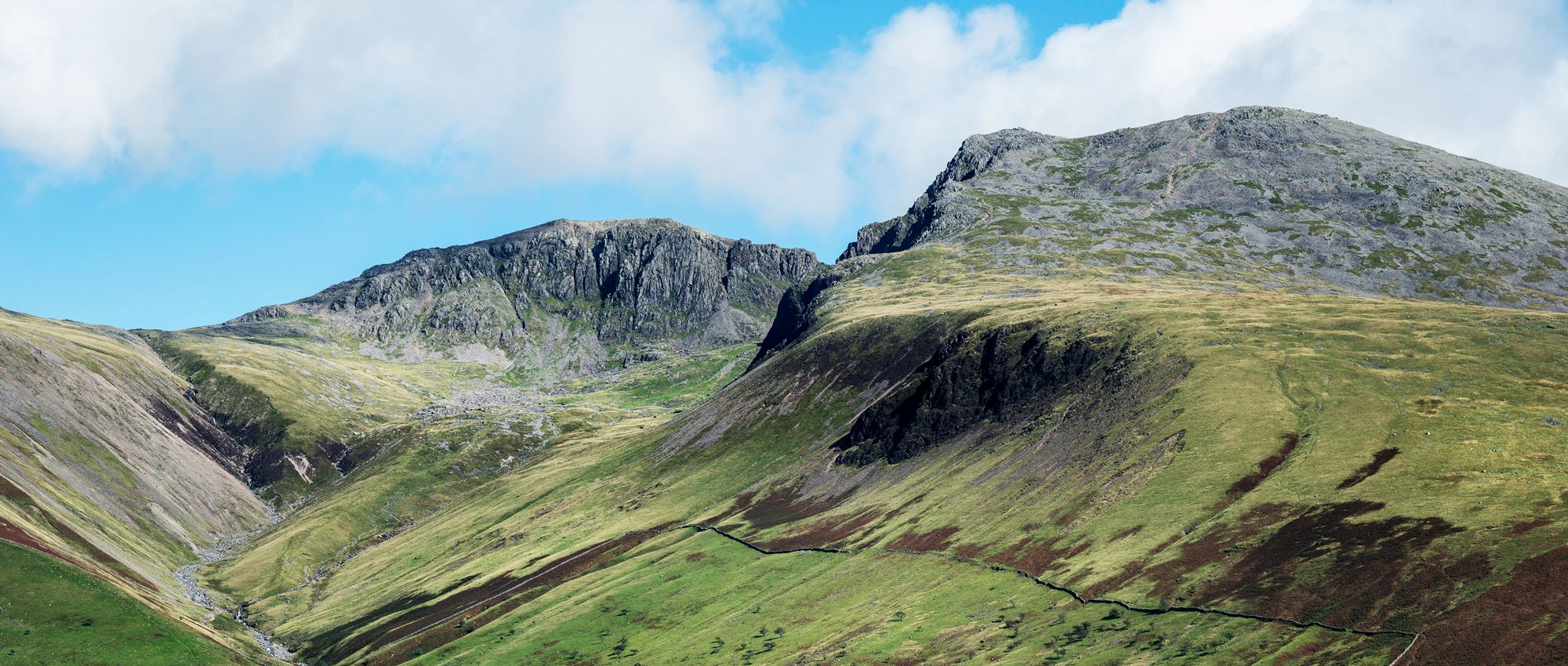
Scafell Pike from Borrowdale - The approach from the north
Starting from Seathwaite in Borrowdale, this is a popular alternative to the Wasdale route. It’s around 9 miles return and takes about six hours. It can be tricky in places, requiring good navigational skills, but the landscapes are spectacular.
The trail climbs steadily at first, then more steeply, zigzagging below Greenhow Knott. Eventually it reaches Styhead Tarn, where several trails converge. Be sure to follow the path along the tarn’s edge towards the Mountain Rescue box. This leads to the start of the glorious Corridor Route, across the side of the fell. There’s a small section of light scrambling but nothing too tough.
The trail continues around the head of the Piers Gill ravine and up to Lingmell Col. As more trails meet, things get busier here. You’ll likely join a line of other hikers making the final push up the scree to the top.
Scafell Pike from Langdale - The long day out
Climbing Scafell Pike from Great Langdale means more time on your feet. The route is almost 12 miles out-and-back, and will take around eight hours. But that means more time spent amid some of the Lake District’s finest fells. And there’s nothing wrong with that, if you have the fitness and skills required.
The trail starts behind the Old Dungeon Ghyll Hotel, which is accessible by bus. It leads below the mighty Langdale Pikes into the Mickleden valley, along the beck. Then it heads up towards Rossett Pike and Esk Hause, the highest foot pass in the national park. There are jaw-dropping views into Eskdale as the trail heads onto Scafell Pike itself.
This route is not for beginners or amateurs. It is a tough, lengthy hike, with a lot of rocky terrain further up. There are few escape points and if the weather comes in it is difficult to navigate. But the pay-offs are some of the best views in the Lakes.
Beyond Scafell Pike - Quieter routes around Wasdale and the west
Just because it’s there, you don’t have to climb Scafell Pike. Don’t feel pressured because so many others are tramping up it. Certainly don’t attempt it if the weather is bad or forecast to worsen. There are many other equally thrilling, enjoyable and less busy routes in the area.
If you are based in Wasdale, there are a range of less-walked mountains and lovely lower-level walks nearby. For instance, try the hike from Wasdale up shapely Yewbarrow. This is a superb vantage for views over Wastwater and the Western fells. While it’s only 628m high, the Stirrup Crag part of the route requires a little scrambling and can be hard to descend.
Another option is a hike above Wastwater’s eastern shore, along the crumbling crags that drop steely to the lake. It crosses over Illgill Head and Whin Rigg, both Wainwrights.
Alternatively, gorgeous Eskdale, one of the Lake District’s most pristine valleys, is a great option for easy walks. Try a 5-mile stroll along its prettiest stretch, from the Youth Hostel to Stanley Force waterfall, which plunges through a lush gorge.
Need to know
When climbing Scafell Pike, wear suitable layers and comfortable footwear with a good grip. Take a compass and map, and have the ability to use them. Also ensure you’ve got a full set of waterproofs, a headtorch, emergency whistle and fully charged mobile phone. Carry at least two litres of water plus snacks. Litter is a big problem on Scafell Pike. Practice ‘Leave No Trace’ principles.
Check the forecast before you go and don’t climb in poor weather. Don’t be afraid to turn back if conditions worsen or if you don’t feel confident with the situation. The route should only be attempted in wintry conditions if you are an experienced walker. In this case full winter kit, including ice axe and crampons, would be needed.
Explore more
We’ve got ideas for hundreds of wonderful walking routes across England, Scotland and Wales, long and short, easy and challenging. Search for routes on our website. Or join a guided walk with a local Ramblers group. Find your nearest Ramblers group and choose a walk that suits your pace, fitness and interests.
All images © Getty
The ultimate guide to hiking Tryfan and the Glyderau
Discover how to plan and enjoy your hikes up and around one of Wales’ most iconic and challenging summits.
The best routes to walk up and near Ben Nevis
How to tackle the formidable Ben Nevis, the UK’s highest mountain, and discover the best hikes close by too.
The ultimate guide to walking up Helvellyn via Striding Edge
How you can hike and scramble up the magnificent Helvellyn, one of the Lake District’s biggest and most iconic mountains.
Campaign with us
We campaign to remove barriers to walking and we step up to protect the places we love to wander.