How to read a map
Tips on map reading for your next walk

Maps are simply an accurate picture of the ground as seen from above. They are scaled down from life size and include symbols to show particular features and landmarks.
Map scales
On a 1:25,000 map, such as an OS Explorer, one unit of length on the map represents 25,000 units on the ground. So 1cm on the map represents 25,000cm or 250 metres on the ground. On a 1:50,000 map, 1cm on the map represents 500 metres on the ground.
Map symbols
The legend or key on the map will show you what the different symbols represent.
Watch our video guide to OS map symbols to learn how public rights of way and other features are shown on the map.

Although a printed map will remain useful for at least a few years, the landscape is ever-changing and you should not be surprised if some features on the ground do not match your map.
Measuring distance
To measure the approximate distance of your route, take a piece of thin string and lay it carefully along the exact route on the map. Then lay the string straight along the scale line on the map’s margin to measure the distance.
Calculating height
Using various features of the map you can get a sense of the shape of the landscape, its height, the form taken by hills and valleys and the steepness of slopes.
Contours are lines connecting points of equal height above sea level that show the relief of the land. On OS Explorer maps, the interval between contours is five metres in lowland areas and 10 metres in mountainous areas. Every fifth contour line is printed more thickly. The closer together the contours are, the steeper the ascent or descent of the hill.
At points along many of the contour lines you will see a number which indicates height. The number is printed so that the top of the number points uphill. Spot heights are shown as a number beside a dot. These appear at strategic points, including along roads where they level out at the top or foot of a hill. These can be a useful guide where there aren't many contour height numbers.
Grid references
All OS maps are criss-crossed by vertical and horizontal grid lines (coloured blue on OS Explorer maps). They are 4cm apart on 1:25,000 scale maps and 2cm apart on the 1:50,000 scale. A grid reference uses six figures to identify a particular spot on a map that is 100 metres square. The first three specify the vertical lines (the eastings) and the second three the horizontal lines (the northings).
Sometimes four-figure grid references are used to give a rough location that covers the map grid square, not a specific point within it.
Taking a six-figure grid reference
To identify the grid reference of the church on this map takes 3 simple steps:

-
Identify the 1km square containing the church. Do this by selecting its left and bottom sides (imagine a letter ‘L’ bounds the square).
-
Take the numbers on the edge of the map for these two sides (downstroke of the ‘L’ first, as you would write it). This gives: 31_25_ (This is the four-figure grid reference of the square).
-
Now an extra figure must be added to each pair of numbers to specify to the nearest 100m where the church lies within the square. Estimate the number of tenths (100m) the church lies from the two sides. Once again start with the downstroke. It is seven tenths from the downstroke and four tenths from the horizontal stroke, so the 6-figure grid reference is: 317254.
Locating a six-figure grid reference
To find a point on a map using a six-figure grid reference, simply reverse the process of taking a grid reference. Remember to start with the eastings (the first three figures) and then move up the northings (the last three).
A helpful reminder is the saying: ‘go along the corridor and then up the stairs’.
More information
The Ordinance Survey provides a wide range of resources on map reading and has a guide to finding grid references.
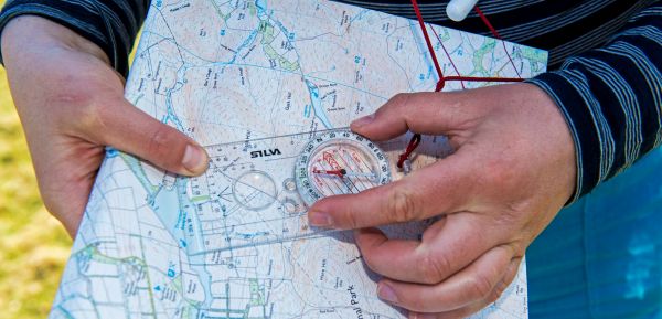
A beginners guide to using a compass
When it comes to walking in the countryside, a compass is the most accurate way of following a map. So here’s our beginner’s guide to using a compass.

Safety
It’s important to stay safe while out walking. Read our guidance on how to be prepared for all situations.
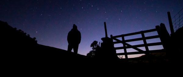
5 top tips on night navigation for beginners
Night time walking can be a great experience. But navigating at night requires extra skills. Read our top tips for fun and safe night navigation.