Hello Everyone
We've had a few enquiries just lately from people who'd like to give the group a try so this walk is for them as well as our own members who prefer something shorter and more local to our usual Sunday forays.
Therefore we're up on Cannock Chase for this one with 6.5 miles worth on mainly good paths taking in the open heathland and forestry thereabouts. There are a few ups & downs consistent with the Chase in general but we'll take our time as always. There aren't any stiles.
As ever, you're welcome to join us whether you're a newcomer or seasoned walker. You'll need sturdy footwear, waterproofs, plus some food & drink for our lunch stop at around half distance.
Registration: 09.45. Walk start: 10.00. Walk leader: Barry C (07811 141484)
No facilities at the start but loo's available at lunch break.
Post walk refreshments will be taken somewhere or other. We'll sort that out on the day!
⚠️Our own members should note there will be no rendezvous at Hednesford this week. Please drive direct to the start, thank you.
See you all there on Sunday morning.
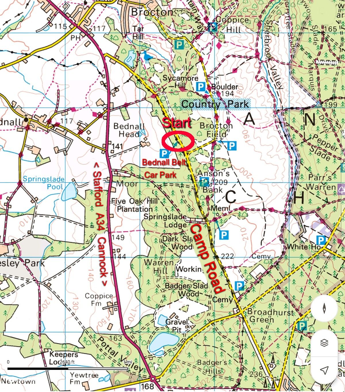
Directions: The start is at Bednall Belt layby car park on Camp Road which runs along the western edge of the Chase connecting Broadhurst Green & the Military Cemetery with the A34 near Brocton, Staffordshire. We have used this car park before - it's relatively easy to find with a couple of important points to note:
1) There is no precise postcode. Springslade Lodge cafe (WS12 4PT) on Camp Road is the nearest but still 0.7 mile away. Please use What3Words, or even the grid reference, both provided in the location details. It's worth also referring to the OS 1:50k map copy of the surrounding area in the photos above to give yourself a better idea.
2) The start car park is situated on the left of Camp Road 0.7 mile after passing Springslade Lodge cafe, also on your left if arriving from the south. ⚠️Ignore the first car park on the left after the cafe and carry on for another 500 yards. Screenshot of the car park and entrance above for your ready reference.
If approaching from the A34 northbound via Cannock proceed on the A34, direction Stafford, for 2.8 miles from the town centre following the signs for the Military Cemetery. After Huntingdon turn right at Pottal Pool Island, direction Rugeley and the military cemetery. Continue uphill for 1 mile to Broadhurst Green Crossroads where turn left into Camp Road and continue past the cemetery on your right and then Springslade Lodge cafe on the left 0.8 mile later.
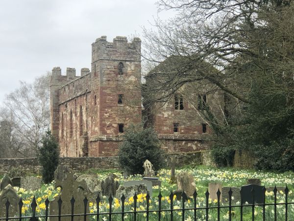
After passing the cafe continue for a further 0.7 mile, ignoring the first layby car park on your left and continue until the next (larger) layby car park also on your left which is Bednall Belt car park. Photo above.
If approaching from Lichfield take the A51 then head for Rugeley town centre via Brereton on the A460 until the miners statues island near the town centre. Straight over this, still A460, then 400 yards later turn left at the lights into Hagley Road and follow the course of the road without deviation for exactly 3.9 miles to Broadhurst Green Crossroads where turn right, signed for the cemetery. Pass the cemetery on your right and Springslade Lodge cafe on your left 0.8 mile later, then as above.
From Stafford pick up the A34 southbound, direction Cannock, and proceed for 2 miles to Brocton crossroads where carry on for a further 500 yards to pass The Chetwynd Arms then turn left into Camp Road signed for Pye Green & Hednesford. Climb uphill for 1 mile exactly where the large Bednall Belt layby car park is on your right.
_1.jpg?itok=TpBaSvoj)
 (Small)_1.jpg?itok=y4Ard-JN)