**Please note that this walk is starting at 10.15 am, not the usual 10.30 am
Update on this walk is that whilst when I recce'd it with Angela on 10 May, it was not possible to follow the official route as it was impassable across the marshes, following the recent hot weather, when I revisited this stretch on 20 May it was OK to get across (just !) - so unless it rains further between now and the 26th we will follow the official trail and do that. If not, then there is an alternative available route for that section. The official route does mean more road-walking (narrow country lanes at Adgestone), but the alternative would be more nettles (beware if you are considering shorts) - so either way be aware, and take care !
My other mini-update is that my brilliant plan for a drinks / loo stop at Brading Roman Villa doesn't work after all, as it transpires they are closed on Sundays (!), though we can access the grounds only en route if we wish
This will be a leisurely walk. Mostly flat. One or two stiles. Some stretches of road-walking, including some country lanes without pavements
We will have drinks stops as appropriate to weather, and a lunch / ice-cream stop at Bembridge Windmill (if you're a National Trust member bring your card if you want a quick drop-in), so do bring drink and packed lunch or snack if wished
Please note there are no public toilets available until Bembridge (near the Pilot Boat). But the Yarbridge Inn is literally en route if we wanted to stop in there for a quick drink
Distance of the walk itself approx 8 miles - plus for those catching the bus back, the additional walk back up to St Helen's Green (bus-stops - and pub !), allow a bit less than 9 miles total
For those who would like a shorter walk, there is and easy and obvious earlier "exit" point to a bus route at Brading (approx 3.5 miles) , or indeed at Bembridge, for buses back to Sandown
~~~~~~~~~~~~~~~~~~~~~~~~~~~~~~~~~~~~~~~~~~~~~~~~~~~~~~~~~~~~~~~
Pursuing the idea of walking some or all of the Isle of Wight's "named trails" in full, this is the second stage of our Yar River Trail, starting in the Central Floodplain section from Sandown to Brading, and then onto the River Mouth section from Brading to the river reaching the sea at St Helens
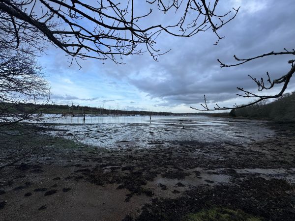
We meet at Sandown railway station, initially an unimaginative route through housing, but then turning off across the marshes and walking via Adgestone (some road walking - no footpath), past Brading Roman Villa and Morton Manor, across to Yarbridge. Then alongside the railway for a stretch (crossing the tracks twice - take care !) , turning off onto the old seawall across Brading Marsh Nature Reserve to Centurions’ copse. From there, on to Bembridge Windmill (lunch / ice-cream stop) and then, largely on-street walking, through the outskirts of Bembridge down to the harbour (toilets), round the embankment and across the Causeway to St Helen’s, which is at the mouth of the River Yar, across the Causeway to St Helen's Duver (refreshments / toilets), which is where this walk ends at the old church on the beach. Those catching the bus back to Sandown (as I will be doing) will need to walk up to St Helens Green for bus-stops
From the leaflet produced by the Island Rivers Partnership:
“Have you ever wondered what it would be like to follow a river on its journey from source to sea ?
Here on the Isle of Wight you can do just that . From a spring in Niton you will see the East Yar river grow from the smallest trickle and gather itself through a host of tributaries before spreading across its floodplain and joining the sea at Bembridge Harbour. Along the way the river will guide you through rolling landscapes, past ancient manors and into busy cosy pubs.
The Eastern Yar, at 19 miles long, is the Island’s longest river, draining over a fifth of its land surface
The Trail divides into 4 parts:
- Niton to Godshill – The Young River – 5 miles
- Godshill to Newchurch – The Developing River – 4.5 miles
- Newchurch to Brading – The Central Floodplain – 4 miles
- Brading to St Helens – The River Mouth – 5 miles"
~~~~~~~~~~~~~~~~~~~~~~~~~~~~~~~~~~~~~~~~~~~~~~~~~~~~~~~~
Travelling
By car
If you have a carshare, park one car at St Helens (or your alternative chosen walk end), and bring the second car back to the start point at Sandown railway station
St Helens has pay carparks on the Duver and the National Trust carpark (free to members ) just behind, in the dunes.
At the time of checking , Sandown station carpark is only £1.20 for the day - buy parking ticket at the train ticket machine – but there is usually free on-street parking in the vicinity. However, depending on where you live, this walk may be more easily (and cheaply) reached by public transport (see below).
If you prefer, or need, car travel then please do consider posting any offers of and requests for carshares on the Whatsapp group to minimise pressure on parking, the roads - and the environment.
By bus
I haven’t listed specific timings as there are several options (and currently the Island Bus timetable is only published up until the previous weekend anyway) , but basically:
- From Newport to Sandown – the No 2 (via Shanklin), No 3 (via Shanklin but also Ventnor…) and No 8
- From Ryde to Sandown – likewise, the No 2, No 3, or (long-windedly via Bembridge) the No 8 – or take the train. The 09.47 train from Ryde Esplanade arrives at Sandown 10.03. This is the handiest arrival mode (if not necessarily the cheapest), so the 10.15am start-time is set to tally with that.
Or car + bus combo
This is what I propose to do - i.e. park at or near Sandown station (sea above), and then bus back at the end of the walk.
Whether you drive or bus/train to the start, we would need to No 8 bus back from St Helens which (on current timetable) departs hourly from – how handy ! - the Vine pub on St Helens Green at :
- 09 mins past the hour to Ryde
- 56 mins past the hour towards Newport (for return to Sandown)
(or in either case a minute earlier from the Guildford Road stop slightly closer to the walk’s end)
Depending on the weather, consider suitable clothing, footwear, walking stick, sun cream, drinks, and food. Watch out for ticks and remove ASAP. If you are unsure about your ability to undertake this walk, please contact the walks leader. If you need to leave the walking group, please ensure you inform the leader or back marker
Please note there are some sections of road walking, some without pavements – please walk in single file and take good care
Please also note we will be crossing the train line twice - please take good care there too
Wise to look at the website on the day just in case of any changes or additional info. And in the event of extreme weather please check back for cancellation /postponement notices. You can also check with Serena on 07564 811690.
New walkers welcome
If you are new to the Ramblers you can just turn up for any of our walks, unless we specify otherwise. We invite you to come along for three walks as a non-member.
Whatsapp
If you would like to join the informal WhatsApp group (or even just temporarily for the purposes of communications regarding this specific walk and then exit again) , please message Serena on 07564 811690 to be added .