1
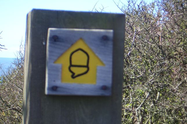
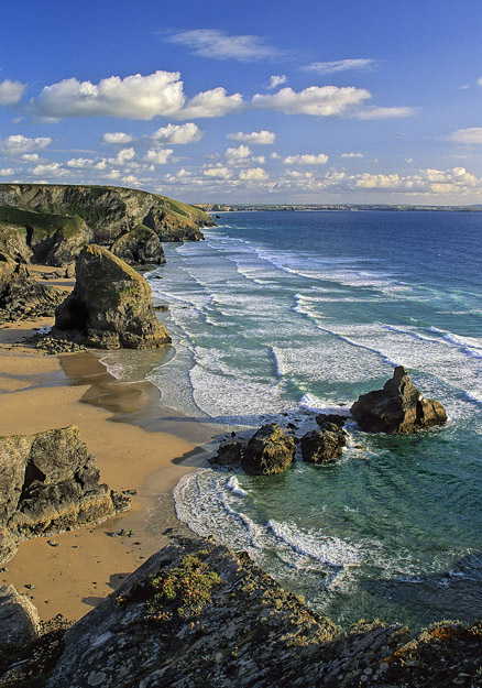
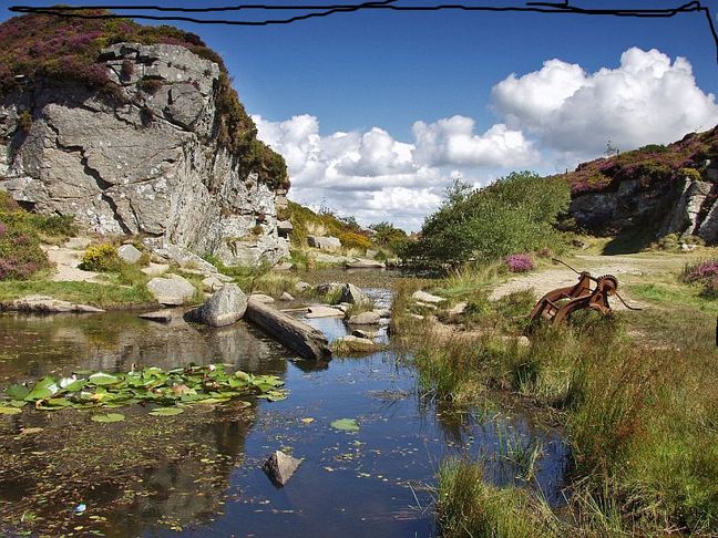
The first part of this walk is way-marked by yellow Acorn direction arrows which indicate the coastal path. Exit the car park and turn left to walk on the seaward side of Rocket House. As you walk across the Warren you pass the old watch tower or folly.
[A] As a watch tower it was built to give warning of pirate attacks from Lundy Island or as a folly, part of a carriage ride up from the Abbey
2
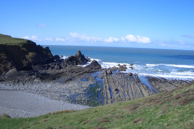
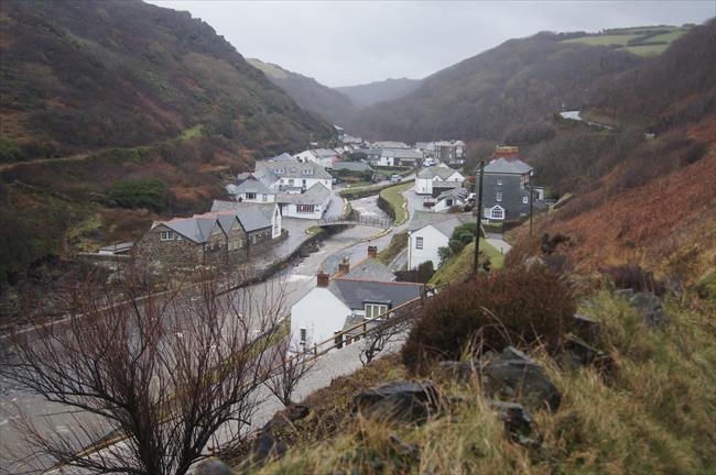
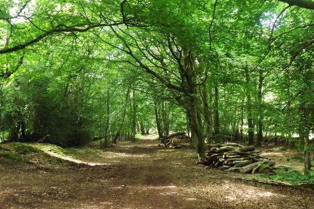
The path descends around Blackpool Mill cottage and up a steep ascent the other side. The path carries on, then down, around another deep valley and up again. You are now walking along Blegberry Cliffs. The path sticks close to the cliff and before the path drops you can take a more level footpath off to the right. If following the cliff path down, you come out into a short shielded valley below Smoothlands. Climb out of this valley, walking inland until the path drops down to take you over a footbridge, past a waterfall and another steep ascent to the path along Upright Cliff
3
At Blagdon Cliff you pass into a field.
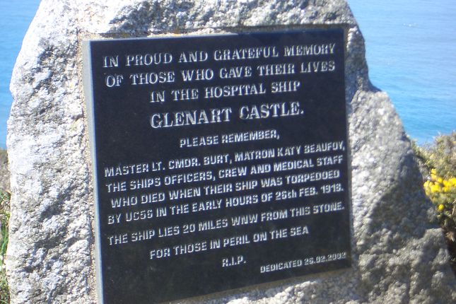
[B] Note the memorial to the crew and nursing staff of HMHS Glenart Castle which was sunk by a U-boat in 1918.
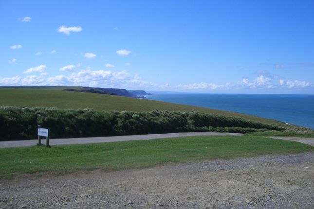
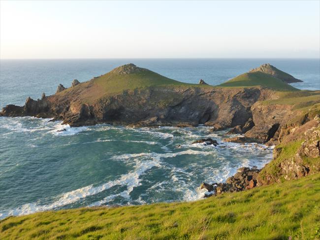
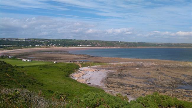
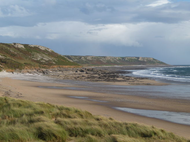
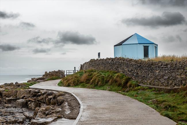
The path then allows you views of Lundy Island and the Lighthouse before dropping down the car park below the Radar Station. This is a good point to rest and have a well earned coffee or tea at the refreshment kiosk. Having rested, climb up out of the car park, past the Lundy Island Helipad and walk straight ahead down to Blagdon Farm along a track leaving the farm and buildings on your left. Pass into and through a field. Very shortly (less than 200metres) at a junction with a finger post (hidden in the trees in summer), turn left , cross a shallow ford and then a footbridge to climb out of the valley on a farm track.
4
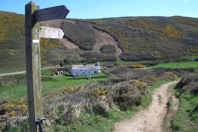
At the metalled road, turn right and walk along to Blegberry Farm.
[C] This farm is the only fortified one in Devon.
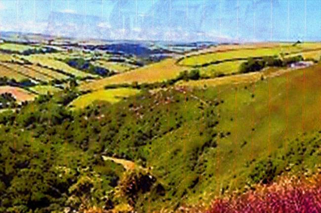
Just before the farm turn left down a track which is followed into the valley and up to the other side until it joins a metalled road above Berry. Walk straight ahead,down and through the buildings of Berry to carry on down the hill.
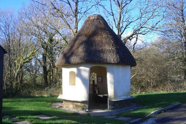
[D] As the road gets a little steeper you might notice a quaint building over the hedge on your right. The is the summer house belonging to Hartland Abbey.
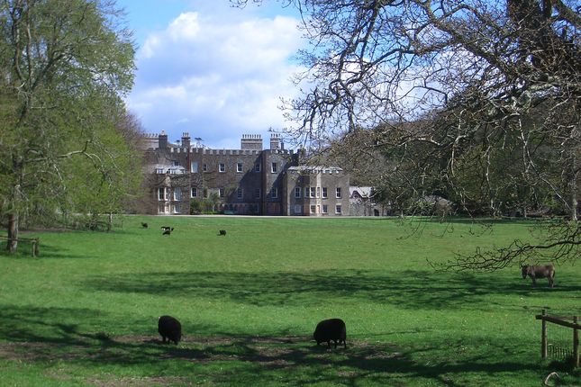
The road continues down into the valley of the Abbey River, the abbey can be seen on your left.
(E) Hartland Abbey - Built in the 12th centuary as a monastery, Hartland Abbey survived longer than any other in the country. In 1539 Henry VIII gifted the Abbey to the Keeper of his Wine Cellar, and today it is the family home of his descendant, Sir Hugh Stucley, his wife, children, grandchildren and dogs! It is probably the most important historic house in North Devon containing much of national interest, including architecture and decoration from the Mediaeval, Queen Anne, Georgian, Regency and Victorian periods.
5
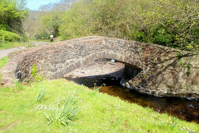
Follow on over a bridge and start to ascend.
The alternative route is off to the right and follows the river down to Blackpool Mill Cottage where your turn left and climb up to the Warren and the ruined tower.
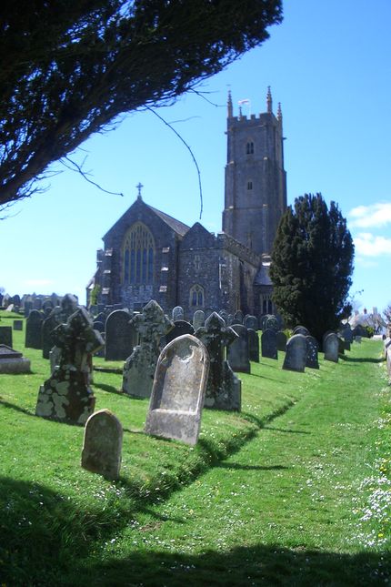
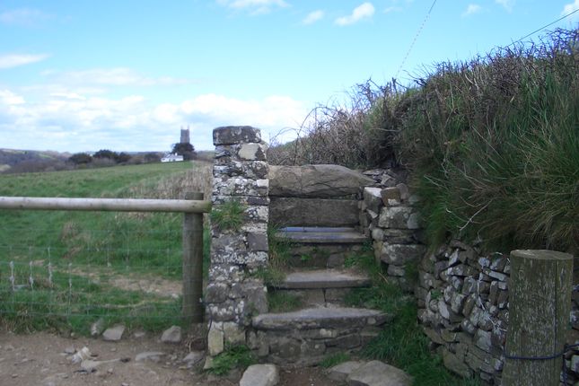
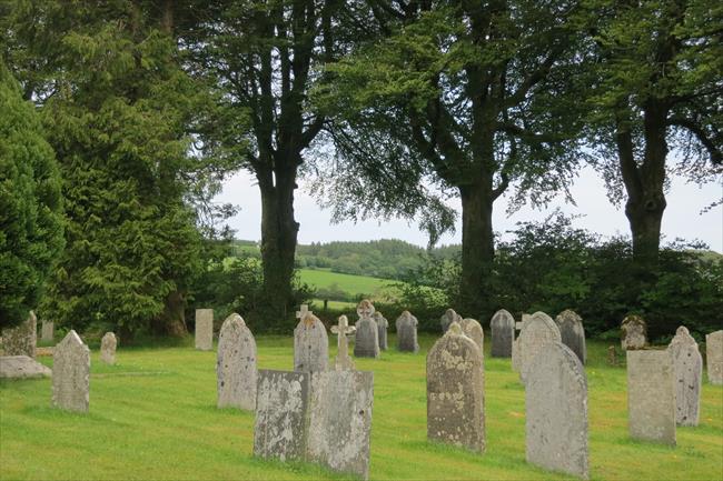
Carry on up the road, through a Z-bend. Opposite the the first house on the left, climb the steps on your right and into the church yard walking straight ahead.
[F] The tower of St Nectans church in Stoke is the tallest in Devon. If you visit the church, you might notice that one of the chairs beyond the rood screen has plaque on it inscribed “Used by Haile Selassie, Emperor of Ethiopia, August 1938” who was visiting the Abbey as a guest.
Leave the church yard by way of the right hand stone stile. Follow the footpath along in front of old coast guard cottages and other houses. Once in the field, follow the left hand hedge until reaching Rocket House and thence into the car park.