Search Results
- Showing results:
- 30 of 74 (ordered by proximity)

Isle of Bute Group
Barone Hill, Isle of Bute
- Difficulty:
- Moderate
- Distance:
- 5.3 miles

Start:
Cnocnicol to Kilchattan Bay
Taking the 9.45am bus south from Guildford Square, Rothesay, to Mount Stuart, to walk from Cnocnicol Wood to Kilchattan Bay.
- Group:
- Isle of Bute Group
- Difficulty:
- Moderate
- Distance:
- 7.0 miles
Start:
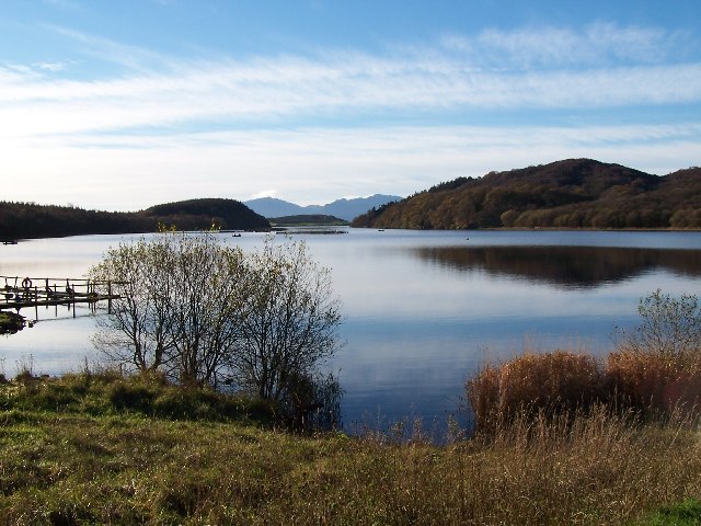
Loch Fad, WIW, Cnocnicol wood, Ascog Hill, Serpentine
10am from the Discovery Centre, Rothesay, to walk to Loch Fad, then via the West Island Way to Cnocnicol wood, Ascog Hill, and return to Rothesay via the Serpentine.
- Group:
- Isle of Bute Group
- Difficulty:
- Moderate
- Distance:
- 8.0 miles
Start:
Skipper Woods
A leisurely walk through Skipper Woods and return to Rothesay along the promenade. Meet 10am at the Discovery Centre.
- Group:
- Isle of Bute Group
- Difficulty:
- Easy Access
- Distance:
- 3.0 miles
Start:
Balnakeilly Wood and WW2 Bunker
9.45am at Chapel Hill car park for car sharing to Rhubodach to walk Balnakeilly Wood and visit the WW2 bunker. Forest paths and tracks.
- Group:
- Isle of Bute Group
- Difficulty:
- Moderate
- Distance:
- 5.0 miles

Start:
Lachlan Bay
Lachlan Bay - a short walk starting from Inver restaurant, across the river bridge leading to Kilmorie Chapel. Return to the bridge and follow the path to the old castle Lachlan. From there a coastal path back. Meet 9.15am Chapel Hill car park for car sharing to catch the 9.40 ferry from Rhubodach.
- Group:
- Isle of Bute Group
- Difficulty:
- Easy
- Distance:
- 3.0 miles
Start:
Tarbert Seafood Festival and walk
Meet at West Kirk car park for car sharing to Rhubodach ferry at 8.10. Drive to Portavadie approx 50 mins, park cars. Go as foot passengers on Portavadie ferry at 9.30 as they are every hour only. Arrive Tarbert 10am for key events of food festival. Cafe C'dora for coffee/breakfast, then seafood festival and street market. Seafood demonstration in harbour. Afternoon various walk options, white beach short easy walk preferred but can add any one of the 3 loops above the castle if time allows. Portavadie ferry home, probably 4 or 5pm and return to Rothesay. Contact the leader on 07757 625494 to arrange car sharing beforehand.
- Group:
- Isle of Bute Group
- Difficulty:
- Easy
- Distance:
- 3.0 miles
Start:
Finish:
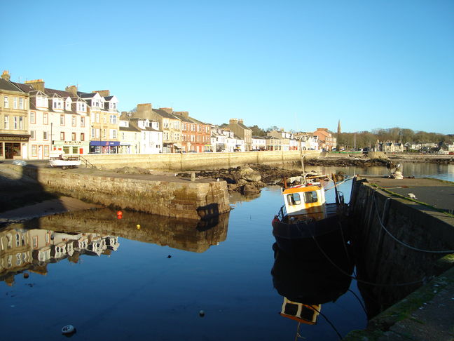
Weekend Away - Rothesay, Isle of Bute
The booking has been made for three nights (Dinner, Bed and Breakfast). Two people sharing a double / twin room - £80 per person, per night. There are no single rooms but twin / double rooms available for sole occupancy at a rate of £98 per person per night. A room with a view of the sea – a supplement of £20 per night. Credit / debit card details will be taken at the time of booking to secure the room but no payment taken (this will be taken on arrival). All are most welcome to join us. Booking is now open with the hotel.
If interested, please contact the hotel directly (tel. 01700 502 500).
Individuals will be totally responsible for their own bookings.
Please remember to state that you are with Dundee Ramblers.
Once you have made your booking, please let Jarka know by email ((jp1093@googlemail.com) – she will keep a list of attendees.
- Group:
- Dundee & District Group
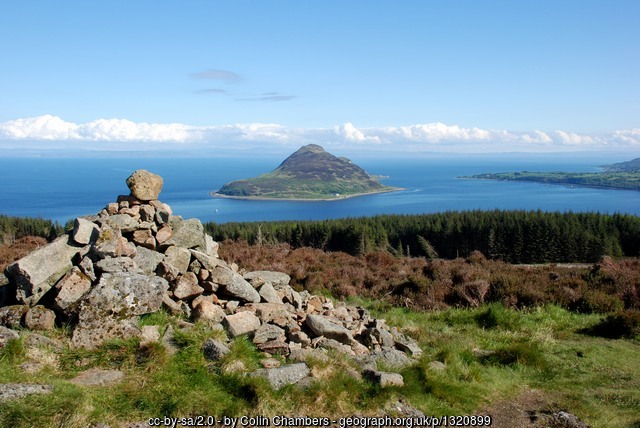
Wildlife and History on Great Cumbrae
- Difficulty:
- Leisurely
- Distance:
- 9.9 miles
The view from Knock Hill, Largs, Argyll and Bute
- Difficulty:
- Moderate
- Distance:
- 8.5 miles

Start:
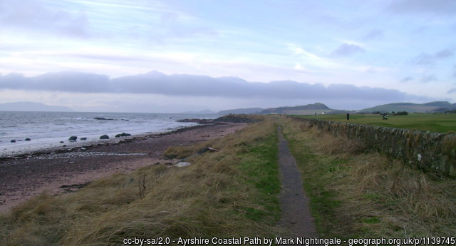
Largs Gogo Glen Circuit
Walkers must book in advance with the walk leader
A walk from Largs climbing above the town and providing extensive views of the Firth of Clyde before descending to a local beauty spot and returning to Largs.
- Group:
- Helensburgh & West Dunbartonshire Group
- Difficulty:
- Moderate
- Distance:
- 8.1 miles

Start:
Fairlie - Largs
A linear walk.
Starting from Fairlie train station we climb up through Fairlie Glen before descending through Kelburn Estate and onwards towards Largs.
There are steep drops going down the Glen and some parts slippy, so care is needed.
Walk is on woodland paths and tarmac some very uneven.
There is a steep section in first half of the walk and 10 steps over a wall with handrail in same section. There are beautiful views of the Firth of Clyde.
It can be muddy in places so boots and walking poles are advised.
Walk local grade C+
- Group:
- Eastwood Group
- Difficulty:
- Moderate
- Distance:
- 7.0 miles
Start:
Finish:
Fechan' Largs Circular - FULL DETAILS WHEN WE HAVE THEM
For your diaries only at this stage. Full walk details will be provided once walk leaders have completed recces and risk assessments.
- Group:
- Cunninghame Group, North Ayrshire
Start:
West Kilbride to Fairlie via The Crosbie Hills
A linear walk from West Kilbride train station to Fairlie train station via The Crosbie Hills. The walk will be along minor roads, hill tracks and footpaths. There will be some uneven terrain with a couple of small stream crossings involved. Wearing of walking boots with good foot support therefore highly recommended.
- Group:
- Glasgow Group
- Difficulty:
- Moderate
- Distance:
- 6.2 miles
Start:
Finish:
West Kilbride to Fairlie: 4 castles, 2 glens FULL DETAILS WHEN WE HAVE THEM
For your diaries only at this stage. Full walk details will be provided once walk leaders have completed recces and risk assessments.
- Group:
- Cunninghame Group, North Ayrshire

Cunninghame Group, North Ayrshire
West Kilbride to Seamill, Ayrshire
- Difficulty:
- Moderate
- Distance:
- 5.0 miles

Start:
North Hill from Ardrossan
This circular walk is fairly strenuous on a variety of surfaces and mixed scenery: farmland tracks, grassy hillsides, windfarm paths, boggy patches, forest paths and shingle beach. There are stiles and gates to climb.
From the carpark we take care to cross the busy A78 then walk a path uphill, over a rail bridge and follow a grassy track to Meadowhead Farm. We follow the road for ¼ mile to the path for Law Hill, between mature trees. There are five stiles and a gate to climb as we make our way upwards across grassy/muddy fields and farm tracks. Near the top of Law Hill, we head east, take a break at a line of trees then head towards Blackshaw Hill where there is an option to do this little extra climb. Over another stile, then we head south following a well-tended grass track around and then through two sections of forestry which are fairly dark. We emerge at a pretty pond, teeming with wildlife where we will stop for lunch and to allow time to check out the Cup and Ring marked rock nearby. After lunch we head up North Hill to the wireless station and cairn then over the other side passing an ancient hill fort towards the wind farm and turbine 15 where we pick up the wind farm paths. We head across open hillsides again to line up a series of farm gates then there’s a bit of tarmac and cobble paths to take us back towards Ardrossan via farmyard, stables and the ruins of Townhead and Montfode Castle. Our final section is along the shingle beach to return to the car park on the A78.
- Group:
- Cunninghame Group, North Ayrshire
- Difficulty:
- Moderate
- Distance:
- 10.5 miles

Start:
Busby Reservoir and Blackshaw Estate
Starting at Busby Reservoir this walk goes through the lovely woods of Blackshaw Estate.
- Group:
- Cunninghame Group, North Ayrshire
- Difficulty:
- Easy
- Distance:
- 4.0 miles

Glasgow Young Walkers Group

North Strathclyde Area
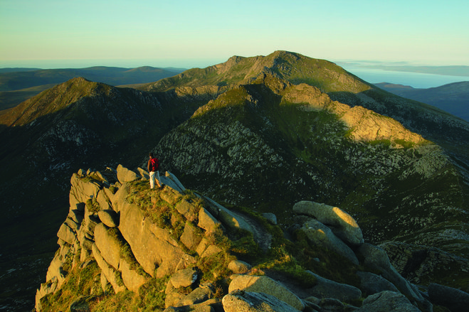
Cir Mhor & Caisteal Abhail, Isle of Arran
- Difficulty:
- Moderate
- Distance:
- 12.7 miles
Start:
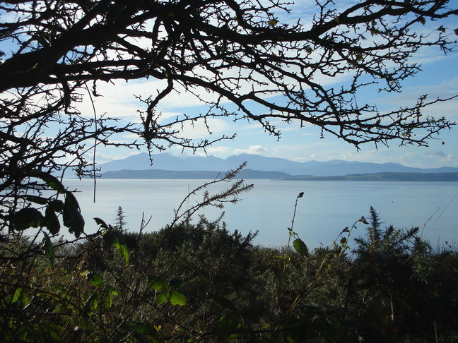
ISLE OF ARRAN : Brodick to Lamlash - coastal path
This is a coastal walk with a mixture of paths, fields, grass with stepping stones, some of it through ferns and some stiles, We walk along to Claughland point where we join a a wider track and we get superb views of the Holy Isle and seals are a very common sight. We continue towards Lamlash and we will have lunch on the outskirts.
The return stretch starts with a gentle climb on the pavement until we reach the Lamlash Golf Club where we join a well established path which runs parallel to the road until it moves slightly away through the forest. The path is undulating and eventually brings us to the outskirts of Brodick where we will walk along the seafront to take us back to the ferry.
- Group:
- Kilmarnock & Loudoun Group
- Difficulty:
- Moderate
- Distance:
- 8.4 miles
Claughland Hills, Arran
- Difficulty:
- Moderate
- Distance:
- 8.8 miles

Start:
Lynn Glen and Blair Estate, Dalry, North Ayrshire FULL DETAILS WHEN WE HAVE THEM
This walk will start from Lynn Glen car park. Leaving the carpark, a short stretch on pavements takes us down to the A737, where we carefully cross and pick up an upgraded path. This path follows the stream until we reach a bridge and a quiet road up to Dalry Station. Gently rising up through Stoopshill, the West gatehouse of the Blair Estate is soon reached. In a clockwise direction the route now meanders through the estate. Through tree lined avenues and attractive wee bridges over the Bombo Burn, the walk is idyllic. When we did the recce, carpets of snowdrops adorned every space. Continuing round the rambler's path past Blair House the circular walk takes us past the old remnants of the walled garden and back to the west gatehouse. Retracing our steps back to carpark, we will continue on to do the lovely, 2.5 miles circuit of the Lynn Glen. This is an opportunity for anyone not confident of walking the total 7.5 miles to stop at this point having completed the 5 miles Blair Estate loop. For the most part, the walking is on good paths but care is needed on the Lynn Glen wooden steps.
This is an easy walk, grade C but moderate C+ if Lynn Glen included.
- Group:
- Cunninghame Group, North Ayrshire
- Difficulty:
- Leisurely
- Distance:
- 7.5 miles
Start:
Finish:
Lynn Glen and Blair Estate, Dalry - FULL DETAILS WHEN WE HAVE THEM
For your diaries only at this stage. Full walk details will be provided once walk leaders have completed recces and risk assessments.
- Group:
- Cunninghame Group, North Ayrshire
Inverclyde Coastal Path: Lunderston Bay – Wemyss Bay
- Difficulty:
- Leisurely
- Distance:
- 5.6 miles

Start:
Around Stevenston
Starting at The Champion Shell pub, Stevenston, this walk will go to Kerelaw Castle, past the old water works and towards Lochcraigs Solar Farm. We pass Ashgrove Loch , nip across Ardeer Golf Course and through fields of long grass to Diddup Farm. Then it is back to Stevenston via on rough tracks, tarmac. and a bit of mud.
There are three things to climb: a gate, a fence and a rickety barrier made of old wood and Heras fencing. Note too, the long grass: there's about 700 meters of this and gaiters will be useful if it has been wet.
- Group:
- Cunninghame Group, North Ayrshire
- Difficulty:
- Leisurely
- Distance:
- 5.2 miles
Start:
Finish:
Kilbirnie to Largs via the Old Drove Road - linear - DETAILS WHEN WE HAVE THEM
For your diaries only at this stage. Full walk details will be provided once walk leaders have completed recces and risk assessments.
- Group:
- Cunninghame Group, North Ayrshire