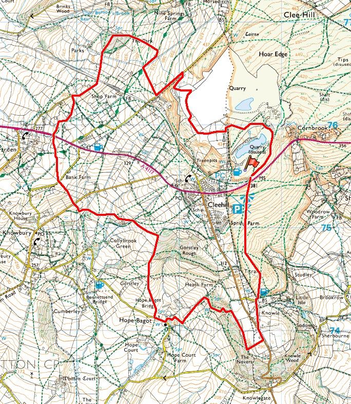
The Clee Hills are the highest point in Shropshire and the only hills to be mentioned on the Mappa Mundi. Their significance dates back millennia, with a bronze age burial site on the summit of Titterstone Clee, as well as the remains of an iron age fort. More recently Titterstone Clee has been the site of much industrial activity, namely extracting the various minerals for which the area is famous. The purpose of this walk is twofold. Firstly we shall be following a route around the hill that offers far reaching views of the surrounding countryside, so fingers crossed for fine weather and clear skies. Secondly, the route has been designed in such a way as to visit some of the more interesting features that allow us to gain some appreciation of what the area must have been like in its heyday.
Any route that encircles the top section of Titterstone Clee is bound to have a few hills, but these are generally graded slopes rather than stiff climbs. The walk starts off heading south west to Hope Bagot before turning north around the west side of the hill where a cluster of stiles awaits (thankfully all in good condition). If the weather holds then mud will be a distant memory. I shall be stopping at several points along the walk to give a brief account of points of interest. Please note that car parking is reached by taking the road to the quarry, which is the first on the left as you leave Clee Hill village from the Ludlow direction. There is a public toilet in the village, a few minutes off our planned route.