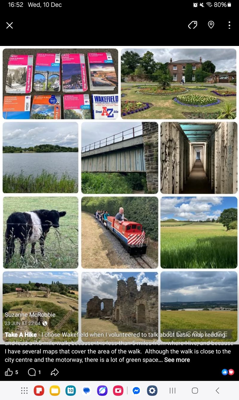
This is a walk I've led several times for Take A Hike. Last year I offered to combine the walk with some basic map reading.
We will only be walking this time - if you want information on map reading, have a look at the OS website.
https://getoutside.ordnancesurvey.co.uk/guides/beginners-guides-map-reading/
Walk Overview
WF2 8DY - 7.5 miles - This is a semi-urban route, which includes pavements, road crossings, canal and riverside footpaths, woodland and fields, and a castle ruin.
Walk Description
Horbury Lagoon and Calder Island may sound exotic, but they are on the outskirts of Wakefield, so be prepared for the sound of local traffic and M1 motorway traffic. The link for Alamy shows an aerial view of the ponds and river, as well as the motorway and local roads.
https://www.alamy.com/stock-photo-aerial-view-of-calder-park-business-park-and-nature-reserve-at-j39-72125030.html
We walk through part of the park, and stop briefly at the Rhubarb Sculpture. After passing the pond we'll have a longer break at the Aviary where people can take it in turns to view the birds. Finally we'll have a look at the flowers in the walled garden (if it is open).
https://chatparks.org.uk/the-parks/97/ Holmfield Park
Once we leave the park, we cross the road and follow a narrow path at the back of some houses; this won't take longer than 5 minutes (see Geograph photo). We'll then turn onto a wider track which leads under the railway to the canal.
https://www.geograph.org.uk/photo/4266510
The canal leads to the Calder river. We follow the river towards Broad Cut. We cross the river via a covered walkway under the railway bridge; this is narrow but it is possible to stand against the wall to let someone pass (see Geograph photo).
https://www.geograph.org.uk/photo/4634228
We walk along a track beside the canal for a short distance then cross Broad Cut Low Lock to rejoin the river. To reach Calder Park we walk through woodland, then fields and then under the M1 motorway bridge.
We walk around Pugneys Park then uphill to Sandal Castle, before heading back down to the river. The remainder of the walk is on roadside footpaths.
Parts of the route may be muddy so please wear appropriate foootwear.