Blanchland North
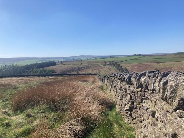
This is a moderate circular route of 9.6 miles, starting from the public car park, just N of Blanchland village centre. We immediately encounter a short but slightly steep climb in a NW direction, past Stot Hill: we continue up to the moorland, and across Birkside Fell, to meet the Carriers’ Way. There are stunning views to the N and W and we continue N, to the very edge of Slaley Forest. After briefly turning S, we then head E across Blanchland Moor. Views of the Derwent Reservoir keep coming in and out of sight. We continue to High Acton Mill and then turn S, off the moor and back onto farmland. This is the likely lunch break point. We meet the road at Acton Mill Bridge: after a few hundred yards of road walking, we pick up a permissive path, which follows the Acton Burn as it descends towards the reservoir. We eventually connect up with a PROW, that goes around the edge of Acton Farm and down towards the road on the N side of the reservoir. There is a further very short spell of road walking to Carrick’s Haugh and then we join the riverside footpath, that follows the River Derwent, back to Blanchland. This final stretch is very pretty and mainly flat, with farmland and woods to the right and the river on the left.
A shorter walk (of 6.4 miles) will also kindly be made available by Dave Marshall.
NB - this walk is not suitable for bringing dogs: apart from the farmland sections, there is a lot of moorland walking and this is the season for ground nesting birds. Sticks might be helpful for some steep stretches and please remember to bring plenty of water with you. There are public toilets in Blanchland.
Directions from Chester le Street
Follow A693, through Stanley, to junction with A692: turn left onto A692 and follow towards Consett and Shotley Bridge; take A691 through Villa Real and down Blackhill Bank; near the bottom, as the road bends to the right, turn left onto Pemberton Road at the crossroads for Allensford; turn right onto the A68 at Allensford; continue on the A68 until left turn for B6278, marked for Edmundbyers and Derwent Reservoir; at Edmundbyers, turn right onto the B6306 and follow to Blanchland.