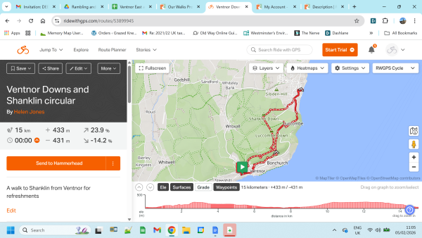
Update : I have now recce'd this walk as part of the walking festival (thank you to Jo and David). Not a great deal to add, save to reiterate that it is a stunning walk / views (assuming good weather / visibility), but the price to pay for which is that it is quite steep in parts, both uphill and downhill. The ascent (1,158ft) has now been added to this listing, and the route is uneven in parts. We won't be doing it at any great speed, but do bring pole(s) if you use them
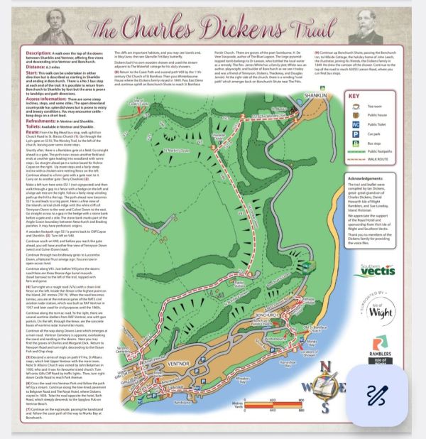
The Charles Dickens Trail
A new (linear) trail ! 😀
"The Charles Dickens Trail has been created as a tribute to the 175th anniversary of Charles Dickens last visit to the Isle of Wight in the summer of 1849 with his family.
The 6.3 mile walk uncovers some of the hidden gems connected to Charles Dickens life".
So….you may well already have heard about the launch of this new and exciting literary Trail, exploring Charles Dickens' links with the Island. For anyone who has missed out on the IOWR AGM and David Howarth's launch at the May Isle of Wight Walking Festival - or simply if you would like to do the walk again ! - I am planning it as a Sunday ramble on the Whitsun holiday weekend.
A great linear route with some stunning views, as well as some Charles Dickens info along the way. Get informed and fit all at one go !
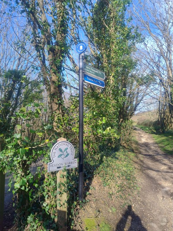
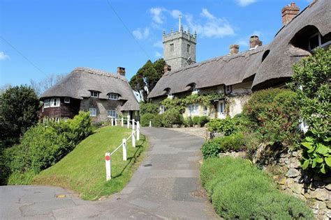
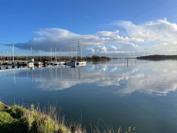
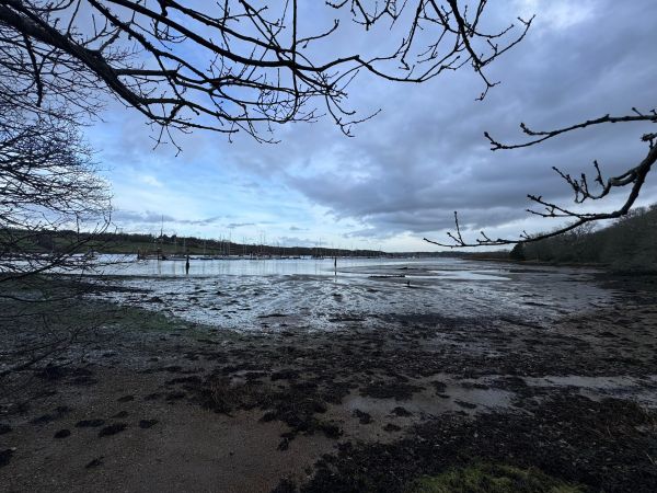
We will start at St Blasius church carpark in Shanklin (by the duck pond at Big Mead) and head up behind the church on the Worsley Trail. A steep climb over the Downs to Ventnor (but worth it for the views) up to the radar station (MINI UPDATE : where Martin our mast enthusiast friend, who some of you will have met on previous mast walks, will be sharing a bit of further Mast knowledge with us). We emerge at Upper Ventnor and then head down to the town / beach (loos , cafes, ice creams etc) for a park or seaside lunch stop. Then picking up the coastal path along to Bonchurch where the Charles Dickens Trail ends (with a further final uphill to the main road). There are handy No 3 buses from Bonchurch Shute stop half hourly ( at 23 and 53 mins past each hour) back to the start of the walk at Shanklin.
[Optional extension : Whilst Leeson Road is the end of the official Charles Dickens Trail, there is the option of making this into a circular walk back to the start point, walking down through Dunnose to Luccombe and back to the carpark. This will add approx 2 miles to the walk. Be aware there is a section of steep and uneven steps on this route. Possibility of a quick visit to the Bonchurch Inn before completing this last section.... (The estimated end time for this walk of 3.00pm is based on the distance to Bonchurch. Obviously if you decide to add on this extension to make it a circular route then it will add on an extra hour or so] .
Be aware : definitely some uphills/downhills in this part of the Island but this should be an interesting walk with a theme, as well as some good views, weather permitting
Toilets / cafes not until Ventnor
TRAVEL:
By car:
There is a free carpark in car park St Blasius Church, but it is not huge so maybe allow enough time to find onstreet carparking in the vicinity in case it is full - and bearing in mind it appears there is a church service at 10.15am on the day of our walk...
(If you are carshare/shuffling then park wherever you can find in Bonchurch)
By public transport - ***UPDATED, AS THE SUMMER BUS TIMETABLE IS NOW OUT*** :
The No 3 bus which leaves Ryde Interchange at 09.15 arrives at Big Mead at 10.10
The No 3 bus which leaves Newport bus station at 09.35 arrives at Big Mead at 10.30
The start of the walk is only a minute or two’s walk from the Big Mead bus stop and I have put back the start time by just 5 mins to allow for this timetable change (but if you are getting the bus which arrives at 10.30 then wise to let us know so we can be doubly sure not to depart without you…)
Car share:
In the interests of the air, parking, and non-drivers, if anyone is able to offer, or needs, a carshare then please post on WhatsApp group (to join group please message Serena 07564-811690)
Bring drinks - and lunch / snack as desired
Depending on the weather, consider suitable clothing, footwear, walking pole(s) (this walk is a steep one, with some uneven steps and surfaces, and additionally may be muddy in parts) , sun cream, drinks, and food. Watch out for ticks and remove ASAP. If you are unsure about your ability to undertake this walk, please contact the walks leader. If you need to leave the walking group, please ensure you inform the leader or back marker
Please note there will be short sections of road walking, and roads to br crossed – please walk in single file and take good care.
Wise to look at the website on the day just in case of any changes or additional info. And in the event of extreme weather please check back for cancellation /postponement notices. You can also check with Serena on 07564-811690
New walkers welcome
If you are new to the Ramblers you can just turn up for any of our walks, unless we specify otherwise. We invite you to come along for three walks as a non-member.
Emergencies
It's very rare that an emergency occurs, but we may need info about
• Any health concerns that you have
• Any emergency contact information
We'd ask you to make sure that we have ready access to this, if needed
GENERAL :
If you would like to join the informal WhatsApp group (or even just temporarily for the purposes of communications regarding this specific walk and then exit again) , please message Serena on 07564-811690 to be added .