Chester-le-Street group logo.

Chester le Street Group

We are the Chester-le-Street Ramblers. We open the way for everyone in our local community to enjoy the pleasures of walking.

Join the Ramblers and enjoy

  • unlimited free access to 50,000 Ramblers group walks
  • a library jam-packed with thousands of tried-and-tested routes
  • a welcome pack teeming with top tips plus our Walk magazine
  • exclusive discounts from our partners
  • knowing your support is opening up more places to walk and helping more people discover the joy of walking
1 of 0

Overview

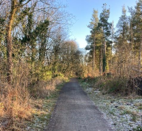
This is a moderate circular route of just over 8.5 miles. We start from Broompark Picnic Site and head W on the Deerness Railway Path. After a very short stretch, we turn S and cross the river, before heading up the hill to meet the road. There is approximately 0.5 miles of road walking (on grass verge) to the W and then we climb SW up the hill, towards the attractive and historical Brandon Village. Looking backwards, there are expansive views over the Deerness Valley and Durham Cathedral can be seen in the distance. From there, we head NW towards the edge of New Brancepeth and continue W in a loop around Esh Wood. From Hill House, we head N onto the old Roman Road path and then E, towards Biggin Farm, and back to the road. A very brief spell of road walking is followed by a descent, back to the River Deerness. Finally, we rejoin the Deerness Valley Railway Path and head E, back towards Broompark Picnic Site.

Although one of the photos shows some beautiful Belted Galloways, they are enclosed in a separate field. The only livestock I expect to be sharing the route with us, in some places, are sheep. There are sections of field walking (with a mixture of stiles and gates) which are muddy in places, and a couple of steep paths, so gaiters and sticks might be handy. However, the majority of this route is on bridlepaths and railway paths, so boot cleaning shouldn't take too long!

A shorter route will also kindly be provided by Dave Marshall.

Sunday, 12 January 2025
Meeting time:
10:00 am
Start time:
10:30 am
Estimated finish time:
2:00 pm
Difficulty:
Moderate
Distance:
13.7km / 8.5mi
Ascent:
N/A
Type:
circular

Meeting point

Grid reference:
NZ 27520 51928
Nearest postcode:
DH3 3UA
what3words:
icons.gazed.flat
Meeting time:
10:00 am

09.50 to meet and 10.00 to leave, at the Old Civic Centre Car Park, Chester le Street, DH3 3UA

Starting point

Grid reference:
NZ 25058 41520
Nearest postcode:
DH7 7RJ
what3words:
focal.glue.stamp
Start time:
10:30 am

10.30 at the Broompark Picnic Site, Durham, nearest postcode is DH7 7RJ, but please check map too. What3Words is ///focal.glue.stamp Directions from Chester le Street A167 S to Nevilles Cross Traffic Lights; turn R onto A690 W; at next roundabout, take 2nd exit onto B6302, Broom Lane; after about 0.5 mile, look for brown sign on left, for Railway Paths Picnic Area; this left turn will take you to the Broompark Picnic Site car park

Join the Ramblers and enjoy

  • unlimited free access to 50,000 Ramblers group walks
  • a library jam-packed with thousands of tried-and-tested routes
  • a welcome pack teeming with top tips plus our Walk magazine
  • exclusive discounts from our partners
  • knowing your support is opening up more places to walk and helping more people discover the joy of walking